From replenishing and regulating the human body to nurturing and fueling our environments, water is a valuable commodity that we cannot live without. In areas where rainfall can be unreliable, or drought often occurs—such as the western United States—alternative methods must be used to supply water to impacted communities and their agricultural regions. With the frequency of droughts in California, groundwater pumping is a widely-used tactic to combat the scarcity of natural water placement, but in time the groundwater used must be recharged to avoid an imbalance.
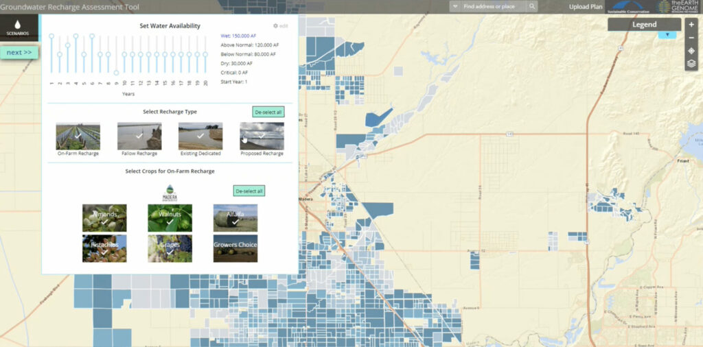
That’s why the Groundwater Recharge Assessment Tool (GRAT) was developed in partnership with The Earth Genome and Sustainable Conservation. It’s a valuable decision support tool that enables Groundwater Sustainability Agencies (GSAs) to identify and prioritize potential groundwater replenishment options to achieve sustainable groundwater supplies. This technical tool was originally created for the Madera and Tulare Irrigation Districts and the Rosedale-Rio Bravo Water Storage District to help model recharge scenarios across different fields using various recharge types. The goal was to help these districts understand where water is, how it can get to crop fields, and how it can be used to prepare for droughts—all while being more sustainable.


Building Out the Application
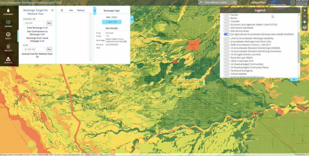
With data from the districts and complex, analytical logic provided by The Earth Genome and Sustainable Conservation, Blue Raster was able to help design and develop GRAT using ArcGIS Enterprise and the ArcGIS API for JavaScript. The application allows users from select California water districts to adjust water availability scenarios, recharge types, and specific crops used in the analysis. The application details site locations, fields’ recharge suitability, and impacted crop types, and visually shows on the map sites where water is placed. A series of charts and graphs provide information on groundwater change, recharge by crop, unused water available for recharge, and costs associated with the proposed recharge.
Blue Raster was responsible for preparing the data for use in the application and converting the analysis logic to an interactive mapping application. Our team formatted the datasets provided by the districts to create the crop layer, apply indices that rank and prioritize sites as well as determine suitability, and allow for different scenarios to be run against the GRAT logic.
Looking Towards the Future of GRAT
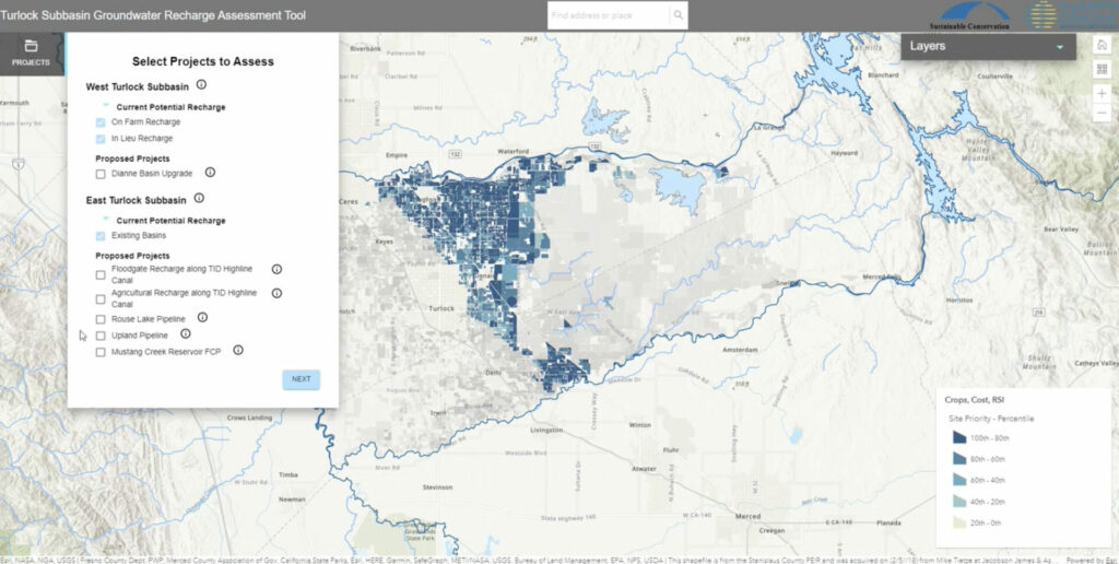
With GRAT being utilized by other GSAs in California, various water districts have expressed the need for more map-centric, data-visualized applications. In 2022, we helped launch the Turlock Subbasin GRAT for the East and West Turlock Subbasins. Similar in purpose and design to the original GRAT tool, the Turlock Subbasin GRAT also features enhancements related to proposed projects that could impact how water reaches fields and is placed and introduces new recharge types.
With the concentrated efforts of The Earth Genome and Sustainable Conservation, and using the GRAT platform, additional water districts throughout Central California can implement more effective and environmental solutions for groundwater recharge. The Blue Raster team looks forward to partnering with both organizations to help ensure groundwater balance and effective management now and into the future.

Interested in Learning More About GRAT?
Contact us to learn more about this application or to discuss how interactive mapping technology can enhance your data.
