ArcGIS Online is a powerful web-based mapping platform from Esri, the worldwide leader in spatial technology. This program works as a single, online location to store, share, and produce advanced maps and spatial visualizations.
Our ArcGIS Online Accelerate solution is designed to help users tap into the impressive power of this game-changing platform. We apply our extensive technical experience and comprehensive knowledge to help you configure, express, and share your data via accurate maps and innovative applications, cohesively through the fabric of ArcGIS Online.
Through this process, you will be able to:
• Establish a geospatial program to share, analyze, and display your work
• Build your own applications for either internal use or sharing with others
• Leverage your GIS investment with a wide range of users and collaborators
• Offer access to your data and maps from anywhere, by anyone you choose
• Create your own map layers from raw data in nearly any format
• Target your mapping to inform specific groups and benefit wider communities
To complement this process, Blue Raster also offers custom HTML5 programming for tailored applications and visual media integration from other platforms that you already use.
Ready to get started? Contact us today to learn more information about Blue Raster’s ArcGIS Online Accelerate!
ArcGIS Hub Accelerate
Let us help with your COVID-19 Hub setup.
ArcGIS Hub is a two-way engagement platform from Esri that connects private businesses, organizations, and government entities with public stakeholders. The Hub interface allows for the sharing of both
1) feedback and opinions, from public to government, and…
2) data-evidenced progress, from government to public.
Blue Raster assisted in the creation of the Economic Development and Community Development Hub Applications, and can support the creation of your own customized Hub Apps and Web Pages. Whether your goals fall under the capabilities of these existing applications, or you need something entirely new and innovative – Our team can make your Hub-based vision a reality.
ArcGIS Marketplace
Blue Raster offers three support packages to help users successfully set up, implement, and launch ArcGIS Hub:
Using our technical expertise and comprehensive knowledge of ArcGIS Hub configurable templates, our team can help you jump start your Hub Apps and Initiatives. Ready to get started? Visit our website to learn more and contact us today!
ArcGIS Indoors Accelerate
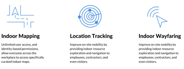
ArcGIS Indoors is a geo-enabled system for smart workplace operations. The system allows operators to unlock workplace data at every scale, enhancing their understanding of occupant needs, to deliver a safer, more productive workplace.
ArcGIS Indoors includes a web application and mobile application (iOS, Android) for viewing the 3D maps, data, and location information. The system is great for facility owners, operators and occupants who can use ArcGIS Indoor’s mapping capabilities to streamline, optimize, locate, and share indoor information. With unlimited user access, the Indoor maps are accessible by all occupants, visitors, and employees.
Let us help you deploy ArcGIS Indoors. Our team can assist with curating and preparing data, authoring maps and scenes for Web and Mobile Apps, and configuration and deployment of Indoors Apps. In addition, we also provide custom solutions to extend the platform, integrate it with third party systems, and customize the UI/UX (branding, colors, icons, images). Visit our website for more information or contact us today to get in touch with one of our GIS Professionals.
ArcGIS StoryMaps Solutions
StoryMaps are web-based multimedia narratives from Esri. Advanced templates featuring numerous configuration and map integration options allow for complete control over the design of your story. The interactivity of ArcGIS StoryMaps transcends any other narrative medium. StoryMaps engage users in a multitude of ways, making them a highly effective in both spreading your message and leaving a lasting impact in your audience.
StoryMaps are renowned for their ability to:
• Engage: StoryMaps are user-friendly, yet insightful. They are visually appealing, content-deep platforms that seamlessly grant viewers a greater understanding of the conditions and implications of your spatial data.
• Share: StoryMaps are accessible everywhere — They can be effortlessly integrated into webpages, presentations, social media, web apps, mobile apps, and more. All to ensure that your message reaches its full exposure among your target audience.
• Collaborate: StoryMaps can be updated with the click of a button. Easily delegate editing and publication access, and track changes as they happen.
Let Blue Raster’s experienced team of designers and GIS specialists curate custom maps and graphics to turn your story into a professional, compelling narrative. Our ArcGIS StoryMaps Starter Kit makes Story Map creation faster and easier than ever before. Fill out our one-page questionnaire and provide us with the building blocks to efficiently configure your next great story.
Configurable Mobile Apps
Mobilize your workforce from a selection of configurable apps and dashboards like Collector, Survey123 and Workforce for ArcGIS. Armed with a collection of configurable mobile applications, take the ability to create, update or delete data away from the office, in both connected or disconnected environments. From collecting survey data to groundtruthing with maps on your device, these applications can be tailored to fit your project specifications. Blue Raster can help you build, map, survey and monitor field work.
With ArcGIS Online, you already have access to the following:
- Collector for ArcGIS
- Survey123 for ArcGIS
- Workforce for ArcGIS
- Operations Dashboard for ArcGIS
- Web AppBuilder for ArcGIS
Let us help you add configurable mobile applications and dashboards to your workflows and discover all the ways it can elevate your work. Interested in learning more? Contact us to learn more about our services and customized, hands-on training.
Microsoft Power BI
Powerful Location Management and Visualization
Power BI transforms your company's data into rich visuals for you to collect and organize so you can focus on what matters to you. Create and edit spatial visualizations directly inside of Microsoft’s renowned business intelligence platform. The team at Blue Raster can guide you on a data-driven path towards your organization's future by implementing the powerful solutions in the Microsoft Power BI platform.
Contact us today to learn more about our Power BI Consulting services.
ArcGIS Marketplace