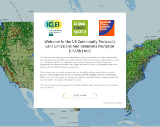
Our Work

Blue Raster helps you tell your story through interactive
mapping technology. Make your message clear, exciting,
and user-friendly for both mobile and web platforms.

ArcGIS Image Extension for Server
Enhanced Performance with Blue Raster’s Cloud-Managed Services: Integrating Zabbix and ArcGIS Monitor for Proactive Management
Blue Raster Pioneering Imagery Management Technology and Delivery Workflows with ArcGIS
Esri ArcGIS Cloud Specialty: Elevating our clients’ GIS capabilities to the sky
Bringing Transparency to Transboundary Water Policy in the Mekong River Basin
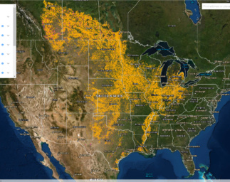
Tracking Grassland Loss in the Great Plains: WWF and Blue Raster Release Plowprint Web Application
A New Chapter on Tsunami Design

Page 1 of 2