Our Work

Blue Raster helps you tell your story through interactive
mapping technology. Make your message clear, exciting,
and user-friendly for both mobile and web platforms.

Building Information Management

Haverford College Campus Placefinder

Like most colleges, Haverford College has a dynamic campus life that requires significant management and planning to run smoothly. But recently, Haverford College decided to make this planning easier on themselves by using the power of GIS to their advantage. They were looking for a better solution for their campus planning, so they partnered with Blue Raster to create the Campus Placefinder.

The Campus Placefinder is an application built for Haverford’s facilities management team that provides an easy-to-use interface to access information about facilities on campus. The application allows users to interact with floor plans, and see details such as capacity and occupancy for every room on campus. The app also creates graphs that detail the area of rooms by building, department, or division. With drawing and printing capabilities, this application serves as a way for users to note changes to campus buildings as soon as they’re needed, and easily create a printout to distribute.

Haverford

Blue Raster built this application to be user-friendly by using custom filters and a search bar so users can quickly find the space they need. Whether the user is looking for a certain building, department on campus, or primary occupant, Campus Placefinder will find the answer, and immediately take the user to the location on the map. With an admin login, a user can edit room information, so the facilities management department can keep all room information up to date. Because the data is hosted through ArcGIS Online, the changes are then immediately available to all other users.

Through this application Blue Raster helped Haverford College improve their facilities data process which will serve the facilities management department as well as Haverford College’s faculty, staff, and students.

Contact Blue Raster today to learn how you can create GIS solutions to meet your needs!

3D Zoning in Washington D.C.

The Washington, DC Office of Zoning (DCOZ) provides assistance and oversight for the District of Columbia Zoning Commission (ZC) and Board of Zoning Adjustment (BZA). DCOZ reviews and accepts applications and enforces zoning criteria. With the help of Blue Raster, robust mapping and GIS tools provide citizens with general understanding and transparency around these criteria, rules and regulations. In 2016, Blue Raster and DCOZ collaborated to create the DC Zoning Map of 2016 and the Historical Zoning Mapping Application. New in 2018, we are excited to announce the next application in the series, the 3D Zoning Map. This new interactive map uses the latest geospatial and 3D technology to provide both residents and developers a tool to navigate and plan the District’s landscape.

DCOZ 3D Zoning image

To assist developers with visualizing what their project will look like against the current landscape, the 3D Zoning Map allows users to delete current buildings, upload new projects, and perform Before & After and Light Study analyses. Using Esri’s ArcGIS API for Javascript, data from DCOZ and the DC Office of the Chief Technology Officer (OCTO) is added to a Web Scene. Additionally, users have the ability to view zoning information from the Zoning Handbook and link to their address in the official Zoning Map.

DCOZ 3D Zoning image
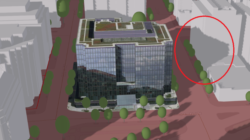
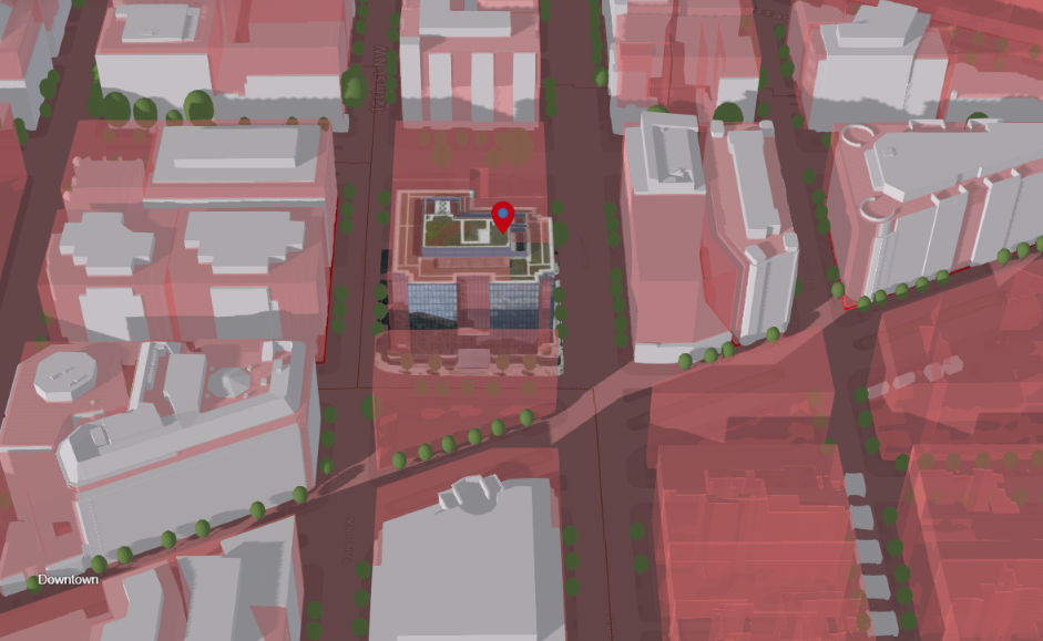
The 3D Zoning Map is an innovative public tool from DCOZ for citizens, developers, and agencies to collaborate and understand the zoning regulations in the nations Capitol.

“Our goal at DCOZ is to always be working towards greater transparency and to be increasing the amount of relevant information we can provide in interesting ways. It is our hope that the 3D Zoning Map will further demystify zoning and land use permitting in the District of Columbia and increase resident’s ability to participate in the process. We are excited to continue our partnership with Blue Raster through the release of the 3D Zoning Map.”  Matthew Holden, Zoning Data Coordinator, Office of Zoning | District of Columbia Government

The Future of 3D Zoning

Building the future of zoning in DC is no easy feat. Blue Raster is currently working with the D.C. Office of Zoning to introduce 3D into a Zoning Map, coming soon.

What can you expect to see? How about something like this:

You like shadows? Maybe see how they change over the day?

How about building heights? They fall inside the building height standards?

Coming soon, in partnership with our friends at the DC Office of Zoning


Exploring George Washington’s Mount Vernon in 3D

George Washington’s Mount Vernon home is a well-loved national treasure, meticulously studied by researchers, restored by preservationists, and visited by a million guests every year. It is the best-documented historic site in the nation, with a trove of information available about everything from the original builders and craftsmen of the house to the individual trees that lived on the grounds in George Washington’s day. Blue Raster shares this information to Mount Vernon’s patrons and stakeholders through an easy and intuitive website, in a partnership with the Mount Vernon Ladies’ Association (MVLA) and Quinn Evans Architects.

Blue Raster developed a prototype online 3D GIS portal for viewing the available spatial, structural, and background information associated with a historic building information model (HBIM) created by Quinn Evans Architects. This includes location information and 3-D modeling and will include details and documents associated with individual elements of the buildings and landscape once the content management system is complete. The tool will make the extensive historical documentation of the estate accessible to scholars, educators, and the public while improving its conservation and maintenance.

mt_vernon_outside

The web application leverages Esri’s ArcGIS API for JavaScript 4.0 and makes use of its WebScene class, allowing the user to virtually explore the estate while investigating documents and historical artifacts. Blue Raster also designed a custom user interface for the application, aligned with the Mount Vernon style guide. Users will now be able to view Mount Vernon and learn about its history in ways never possible before.

mt_vernon_inside

Be sure to take a look at this new 3D web application today, and explore the Mt Vernon property, inside and out!