Our Work

Blue Raster helps you tell your story through interactive
mapping technology. Make your message clear, exciting,
and user-friendly for both mobile and web platforms.

Disaster Response

Blue Raster Pioneering Imagery Management Technology and Delivery Workflows with ArcGIS

Many organizations prioritize the accessibility of imagery and image-derived products for visualization and analysis among both internal and external users. As such, efficient  management and delivery workflows are crucial for these organizations to fully harness the power of spatial data and maximize their product impact. Use cases for aerial images and raster data include land cover classification, urban planning, natural resource management, emergency response and disaster management, precision agriculture and conservation, environmental monitoring and change detection/climate change analysis.

Blue Raster specializes in utilizing the robust capabilities of GIS and cloud services to facilitate the seamless assembly, analysis, management and dissemination of multiresolution imagery, and raster data from different sources and timeframes. Our expertise helps organizations enhance their spatial data management and analysis capabilities.

Employing ArcGIS for Imagery Hosting, Analysis & Management

Empowered by cutting-edge technology, Blue Raster excels in tapping into the full potential of ArcGIS for image hosting, analysis, and delivery workflows across ArcGIS Enterprise, ArcGIS Pro, and ArcGIS Online. With ArcGIS Image Server and ArcGIS Image for ArcGIS Online, we enable organizations to host and conduct dynamic imagery analysis on an unprecedented scale.

The scalability and performance of ArcGIS Image Server redefines the boundaries of what is achievable in geospatial analytics. Additionally, by integrating imagery into the ArcGIS Online platform, organizations can create compelling and informative maps that facilitate a deeper understanding of their spatial data.

Providing On-Demand Imagery Delivery Services

We specialize in providing swift, on-demand collection and smooth delivery of imagery through versatile means including API keys, custom widgets, online user interfaces, and application plugins. Our expertise ensures that you have the necessary tools and support to cater to diverse requirements and preferences.

Whether you need quick access to specific imagery, or a tailored solution embedded within your applications, Blue Raster stands ready to assist, offering a range of flexible and efficient options to meet your unique needs.

Furthermore, we recognize the importance of seamless delivery workflows in ensuring timely access to critical imagery resources. Our solutions are designed to optimize delivery pipelines, minimizing latency and maximizing efficiency. Whether it's delivering imagery to remote field teams or integrating seamlessly with existing systems, we prioritize speed, reliability, and scalability to meet the dynamic needs of our clients.

Our commitment to innovation extends beyond just technology; it's ingrained in our culture. We're constantly exploring new ways to push the boundaries of what's possible, whether it's through advancements in artificial intelligence, cloud computing, or data visualization. By staying at the forefront of technological innovation, we empower our clients to stay ahead of the curve and achieve their objectives with confidence. Our teams of professionals are here to assist you in developing and deploying your delivery workflows.

Pioneering Collaborative Cloud-Based Imagery Management

For over a decade, Blue Raster has been working with clients and partners to deliver large volumes of imagery to support various geospatial workflows. Our cloud specialty has opened new frontiers for collaborative  management. Maximizing the cloud's scalability, organizations can now store, share, and analyze vast amounts of data in real-time. This not only streamlines internal processes but also facilitates effortless collaboration with external stakeholders.

Across the globe, our clients and partners are employing our services to manage and deliver their imagery to support their projects and organizational goals. Here are some examples:

Learn more about our work here

Contact Us

  • This field is for validation purposes and should be left unchanged.


Creating Effective Disaster Preparedness, Response, and Recovery Resources for the Nevada Division of Emergency Management

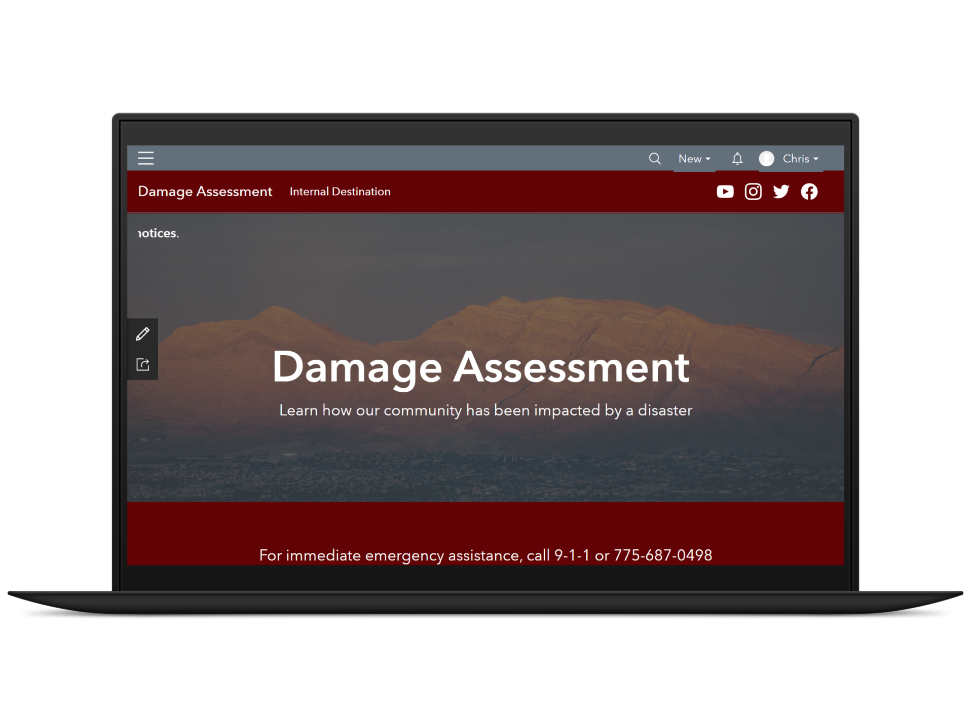
In 2020, the State of Nevada’s Department of Public Safety began discussing the possibility of using Esri’s ArcGIS disaster response and damage assessment solutions to support emergency preparedness, response, and recovery more efficiently and effectively within its Division of Emergency Management (DEM). With Blue Raster’s extensive knowledge on these configurable solutions, Nevada’s DEM selected our team to partner together to build out the Preliminary Damage Assessment (PDA) Tool utilizing ArcGIS in Nevada’s specific environment.

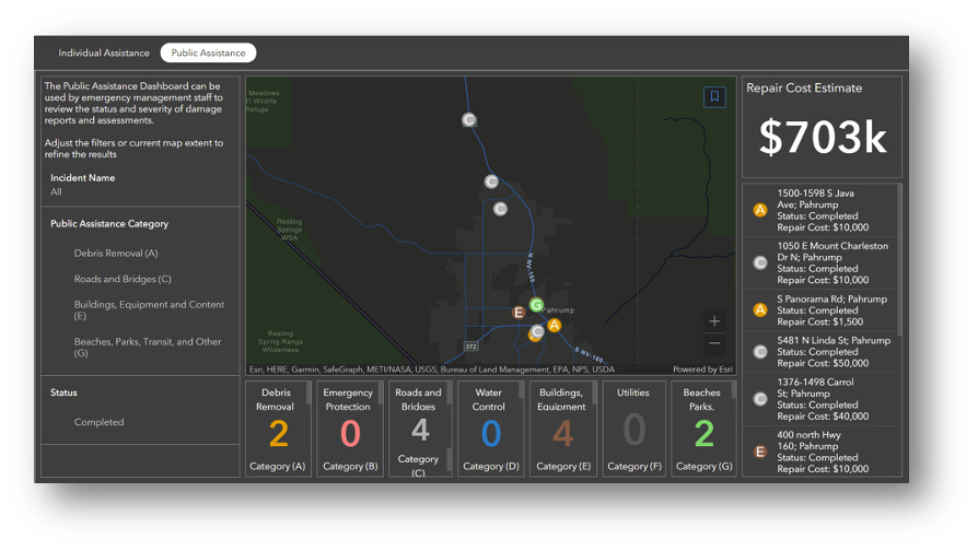
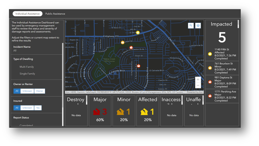
NVDEM Damage Assessment

With the PDA Tool, Nevada’s DEM is able to:

  • Conduct initial damage assessments following natural disaster(s) or destructive event(s)
  • Capture the extent and severity of damage to property
  • Streamline evaluation of need for resources and acquisition of resources after disaster(s)
  • Aid emergency management
  • Collect damage reports
  • Perform initial assessments
  • Monitor the impact of disaster(s)
  • Provide critical information to stakeholders and the public

For the next few months, our team collected the necessary data to bring into the ArcGIS applications; configured and tested the disaster-management capabilities; and created several workflows in ArcGIS Online, ArcGIS Hub, Survey123, and ArcGIS Dashboards that would soon be presented to Nevada representatives from the state and local levels, as well as tribal lands.

To successfully build out the services Nevada DEM needed, our team also collaborated with Esri to secure the purchasing of Surge Licensing activated through Esri’s Disaster Response Program and requested through the State. With Surge Licensing, the division can request as many additional licenses as needed during the time of a disaster response without having to manage a large number of users on a day-to-day basis.

Nevada DEM’s PDA Tool utilizes:

  • ArcGIS Online to host and serve out content to the applications within the PDA Tool—including ArcGIS Dashboards, Survey123, and ArcGIS Hub
  • ArcGIS Dashboards to provide a comprehensive, at-a-glance view of the data and monitor trends
  • Survey123 so data can be collected via forms that are built into the tool; this includes operational surveys that can be accessed through the Damage Assessment Content group

ArcGIS Hub which offers a public site for county and local users and an internal destination for Nevada DEM; it also serves as a platform for connection and engagement between government entities and residents and promotes resources and data that are useful to the community

ArcGIS Experience Builder which is the configurable solution Blue Raster used to build the PDA Tool web application

In 2022, once the PDA Tool was in a good place, Nevada DEM brought in stakeholders—who were county officials, DEM employees, and local community and tribal leaders—so our team could deliver a series of trainings in their Emergency Operation Centers (EOC). Blue Raster GIS Analyst Andrew Patterson traveled to Carson City and Las Vegas to provide on-site, day-long trainings at the Nevada EOCs. These sessions included hands-on demonstrations, out-in-the-field practice, and thorough documentation so attendees could take what they learned during the training back to their communities and teach other people how to use this beneficial tool.

“Providing on-site training for Nevada DEM was a fantastic learning and teaching experience. I was able to work directly with the DEM’s GIS project manager and lead grants coordinator to provide day-long trainings at both the Carson City EOC and North Las Vegas City Hall. We used these trainings to not only showcase and teach the Preliminary Damage Assessment Tool but to also provide education on damage assessment best practices and its importance.” – Andrew Patterson, GIS Analyst, Blue Raster

NVDEM Training

Be Prepared in the Face of a Disaster

Blue Raster excels in creating fully operational emergency-management solutions. Interested in learning more? Contact us today to tell us more about your needs.

Disposal of Debris after Disaster: Blue Raster partners with CDR Maguire to quantify and monitor disposal of debris material

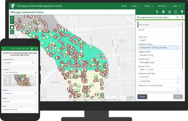
Following a catastrophic event, the assessment and removal of debris and clean-up efforts of those impacted can create a ripple effect of challenges that communities are forced to overcome. To aid in an efficient approach, crews need assistance quantifying the damages incurred and coordination of how best to begin to confront the disposal of debris. After a referral from ROK Tech, CDR Maguire GIS Manager Deepali Datre reached out to Blue Raster to begin work on deploying the Esri Debris Management Solution with a custom enhancement to support online and offline use.

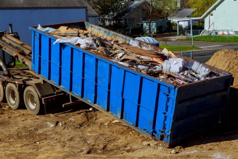
Debris Management

In this data collection phase of disaster response, Blue Raster and CDR Maguire:

  • Customized and extended the Esri Emergency Debris Management Solution to work offline
  • Configured complex and innovative Survey123 forms
  • Authored and deployed custom Python and JavaScript scripts
  • Recorded information including vehicles in operation, field monitors, type of debris accumulated, method of disposal, and total weight removed per truck load
  • Calculated total weight removed using the truck’s empty and full weight measurements obtained from the weight scales at the final dump location
  • Isolated categorical information including truck certifications, loading tickets by address or parcel, and the amount and type of material removed from each designated site

To manage and visualize the data for CDR Maguire, Blue Raster configured an ArcGIS Experience Builder Reviewer Tool. Utilizing this tool, field contractors can submit field survey forms to develop initial damage reports. The Experience Builder Dashboard provides real-time data to increase oversight and efficiency. These methods provide CDR Maguire with accurate data collection for FEMA reimbursement requirements. Throughout this project, the CDR Maguire team was knowledgeable and a collaborative partner to ensure that a workable solution was created.

Example of ArcGIS Emergency Debris Management Solution, courtesy Esri

While this solution was initially developed to assist in the removal of debris from the Boulder County Marshall Fire, this technology has already been employed to address a similar situation following a wildfire in Texas. The applications of this solution translate to a multitude of circumstances in which the efficiency of response can allow for a swift reaction to any type of natural or man-made catalyst.


Esri Nonprofit Specialty: Enabling Nonprofits to Use GIS for Greater Impact

Esri Nonprofit Specialty

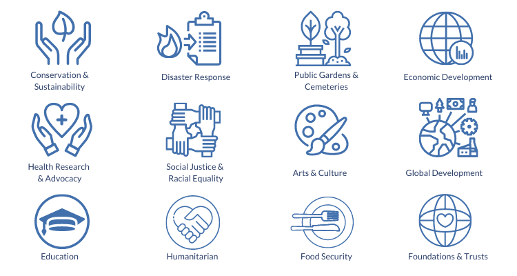
Blue Raster is a proud member of the Esri Nonprofit Specialty. Partners receive this Nonprofit Specialty designation for their alignment with and their knowledge and expertise of Esri’s Nonprofit Organization Program. Additionally, we demonstrate experience with projects in many nonprofit industries: conservation, humanitarian, disaster response, food security, community development, racial equity and social justice, health research, and more.

Esri Nonprofit Specialty

The Esri Nonprofit Program provides nonprofit organizations low cost licenses and access to a Esri's vast offerings of location intelligence tools and training. We are proud to support a wide variety of nonprofit clients in using these location intelligence tools to help inform decisions and shape programs that meet the needs of their constituents. Receiving the Esri Nonprofit Specialty designation is an exciting next step in furthering our mission to help nonprofit and NGO clients achieve their goals.

Nonprofit Experience

Blue Raster has deep expertise developing platforms for managing and disseminating geospatial data and analysis to support conservation efforts with the Esri ArcGIS platform. Since our founding in 2002, we've had the honor of working with over 70 nonprofits and NGOs. For example, we work with leading nonprofit conservation organizations including the World Resources Institute, the Jane Goodall Institute, The Nature Conservancy, World Wildlife Fund, Wildlife Conservation Society, NatureServe, National Audubon Society, Stimson Center, and more.

Nonprofit logos

Blue Raster continues its commitment to bringing the latest in geospatial technologies to leading conservation, global development, humanitarian & disaster response, social justice, and health research & advocacy organizations.

“We look forward to expanding our work in the nonprofit sector as part of this Esri specialty,” commented Michael Lippmann, Principal/Founder of Blue Raster. “Our team thrives on helping organizations make connections between data to better communicate and power their impact.”

Esri Nonprofit groups

Are you a nonprofit looking to better utilize your data?

Contact us today to learn more about the Esri Nonprofit Organization Program!

Nonprofit Specialty

StoryMaps in the Time of COVID-19: Telling the Story of the Red Cross Response Efforts

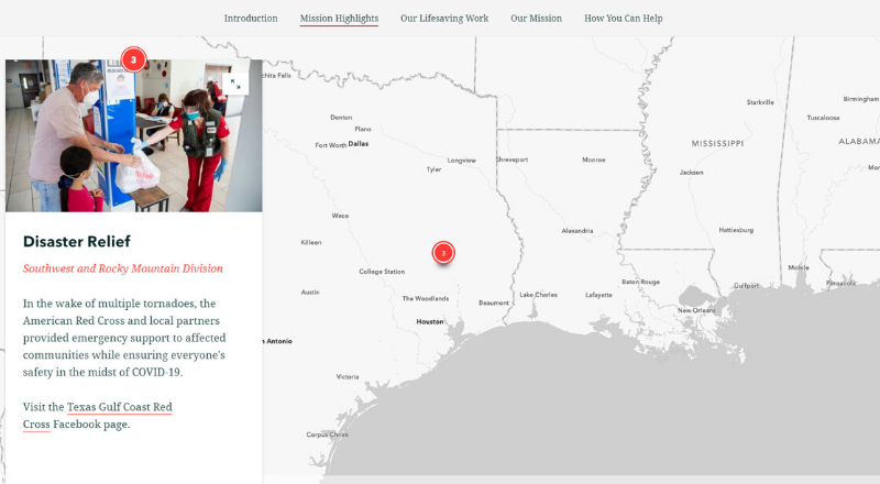
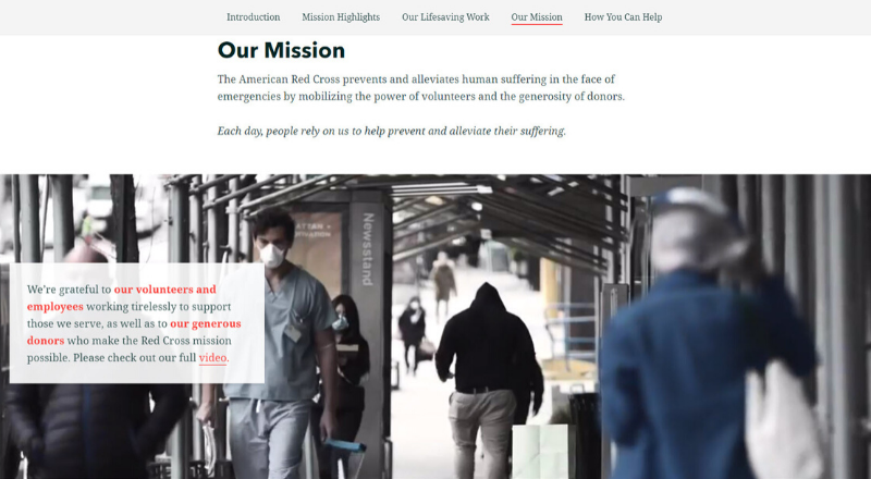
While a large portion of the country and world is doing its part to stay indoors during the coronavirus (COVID-19) epidemic, organizations like the American Red Cross continue to provide disaster relief. What do these efforts look like during times of COVID-19? To highlight these efforts, Blue Raster collaborated with the Red Cross to publish a new story map: How the Red Cross is Helping During COVID-19.

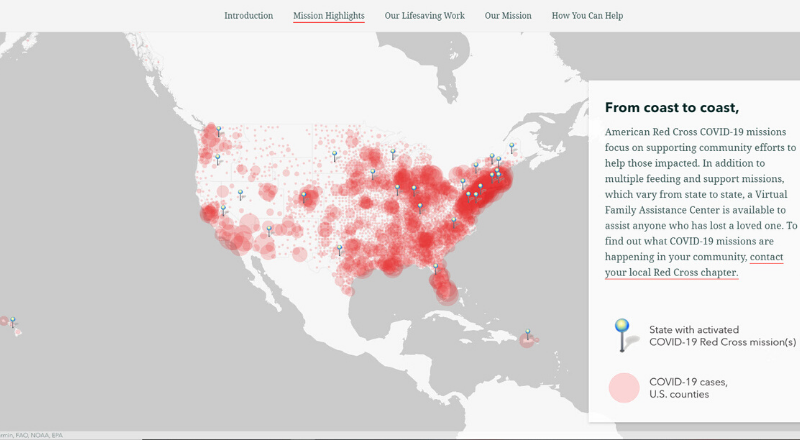
The goal of the story map is to showcase how the Red Cross has shifted its operations while continuing to fulfill their lifesaving work to alleviate suffering despite the pandemic. Additionally, since the coronavirus disease impacts different regions in different ways, the story map highlights what COVID-19 relief missions look like across the country. Just as important, it provides the reader with resources for how to help.

Red Cross StoryMap Details

To portray the significance of the Red Cross’s efforts, Blue Raster leveraged ArcGIS StoryMaps platform. We were excited to configure the new Navigation bar. This allows the read to skip the scrolling and jump to a section of interest. The new floating panel layout for the Sidecar allows the featured photos to tell more than a thousand words. In addition, the Express Map helps highlight the geographic breadth of the Red Cross’s COVID-19 response. Thanks to the photos provided by the Red Cross, the story map provides an intimate look into the interactions between the Red Cross relief teams and those being assisted during a time of strict distancing. View the full Red Cross StoryMap here: How the Red Cross is Helping People During COVID-19

In times of COVID-19, Blue Raster prioritizes helping organizations like the Red Cross tell their story in a meaningful and impactful way. Learn about COVID-10 Response efforts using ArcGIS. We are ready to assist your organization with the rapid setup of ArcGIS platforms that best suit your needs, such as Operations Dashboards, ArcGIS Hub, and Experience Builder, and more.

Contact us today to learn more about how we can assist your organization.

Contact Us

  • This field is for validation purposes and should be left unchanged.