Montgomery County Department of Transportation (MCDOT) is giving its citizens a say in the latest Flash Bus Rapid Transit (BRT) configuration, locations, and corridor termini serving Takoma Park, Langley Park, and White Oak—and ArcGIS is helping make it all possible.
With its New Hampshire Avenue BRT planning study, MCDOT is providing Montgomery County residents with the opportunity to explore and evaluate four transit alternatives that include the best Flash bus routes, future station locations, transportation connections, and more.
Blue Raster Joins the Route to Improved Transit
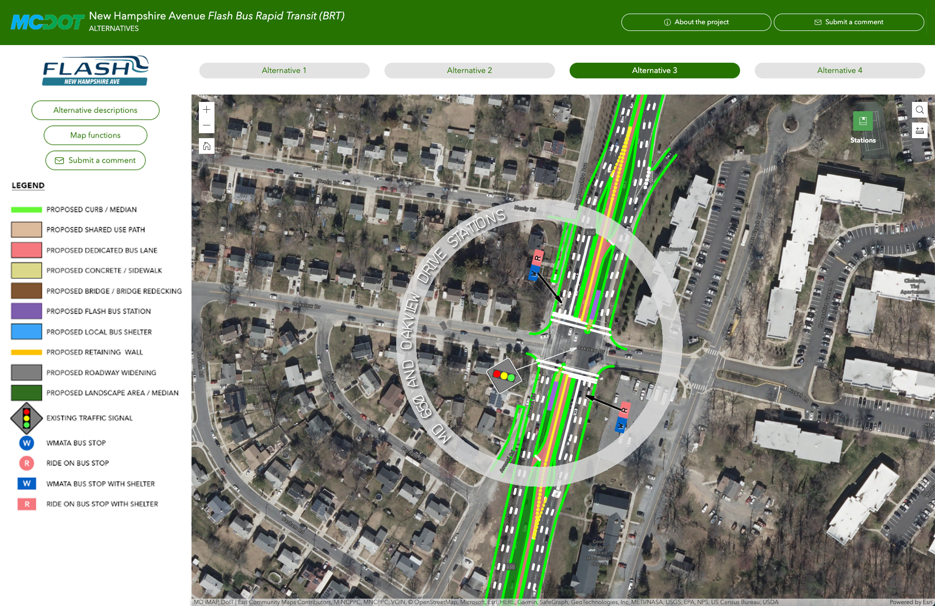
To make this study successful, MCDOT and a group of partners (including transportation communications experts Sharp & Company, engineering firm Kittelson & Associates, and Blue Raster) needed an engaging way to portray the four different alternatives and make them easily digestible for the community members who would be viewing, interacting, and commenting on them. That’s when Blue Raster was able to get behind the driver’s seat. Working with the partners, our team created the New Hampshire Avenue Flash BRT Alternatives Map—using ArcGIS Experience Builder to create the application and map that portrays the different alternatives.

The Map that Leads the Way
This map provides people who live in the area with a visual depiction of MCDOT’s proposed changes, allowing them to determine if they could be potentially impacted by these transit modifications and giving them the power to help improve the service. After examining the suggested options, users can voice their opinions, suggestions, or concerns directly in the application through a Survey123 form that Blue Raster initiated, giving MCDOT direct access to the public’s thoughts and fueling the results of the planning study. Though the study is still being conducted, it’s a privilege to be part of a project that allows our team to showcase our understanding of the transportation industry and its needs and influences the direction of a countywide transit service.

Help MCDOT Pave the Way to Better Bus Rapid Transit
Learn more about MCDOT’s BRT planning study and explore the New Hampshire Avenue Flash BRT Alternatives Map. Make sure to submit a helpful comment to make a difference in future transit planning!
Related Posts
- Creating Effective Disaster Preparedness, Response, and Recovery Resources for the Nevada Division of Emergency Management
- Disposal of Debris after Disaster: Blue Raster partners with CDR Maguire to quantify and monitor disposal of debris material
- Transitioning from Web AppBuilder to Experience Builder: Get Ready for a New Experience
- South Park Arboretum’s Plant Finder uses ArcGIS Experience Builder to Showcase Restoration Efforts
- Exploring Commercial Real Estate from a New Perspective: Blue Raster Partners with AerialSphere
