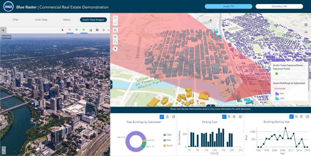
Selecting the right location for a commercial real estate project can be daunting, given the numerous factors that need to be taken into consideration. Often, this is done utilizing an overhead view of properties. Use of an Oriented Imagery Catalog (OIC) from AerialSphere and the Oriented Imagery widget now available from ESRI affords the opportunity to explore properties in an immersive 3D environment.
In this Commercial Real Estate application, Blue Raster:
- Utilized Open Street Map data from ESRI Living Atlas
- Configured multiple filters based on commercial real estate needs - submarket, available square footage, parking cost, and year built
- Built Dashboard and 3D Scene elements to dynamically reflect filters applied
- Integrated imagery from AerialSphere to show a point of view from a specific location or floor
- Generated dynamic viewsheds to illustrate what can be seen from that location
- Calculated travel time analysis polygons for multiple modes of transportation (both walking and driving)

Blue Raster configured an ArcGIS Experience Builder application to aid in the exploration of relevant commercial real estate data in a 3D scene. Utilizing this application, real estate investors can hone in on the properties that meet their needs with specific parameters, and easily traverse the map to further explore the properties. The integration of 360 degree imagery from AerialSphere provides a more immersive experience, and allows the user the ability to pan, zoom in, zoom out, and explore viewsheds from a given vantage point. This can make all the difference in understanding the suitability of a site.
While this solution was originally developed to aid in the exploration of commercial real estate properties, this technology can be implemented for a number of other industries. Contact us today to see how we can use this technology in your organization!
Thanks to Kat Clifton and the team at AerialSphere for their collaboration on this case study.
