Ahead of the November 2022 election, the Georgia Secretary of State (SOS) Elections Division approached Esri and Blue Raster to develop an efficient, well-defined process for mapping registered voters—helping election officials ensure voters were assigned to the proper polling places after redistricting. With nearly 8 million registered voters spread across 159 counties, Georgia officials needed an affordable and efficient solution to geocode each voter in the state with a verification process that could be overseen and managed at the state and county levels. This new tool would need to be active and ready for use by the end of February 2022—a turnaround time of less than two months—in addition to training election officials.
Meeting the Distinct Needs of Georgia SOS
The Georgia SOS Elections Division required one resource that would:
- House every county’s unique voter data
- Alert election officials of any inconsistencies within the system
- Allow election officials to make necessary corrections
- Account for a variety of users and levels of permission—as state election officials would need to access records for the entire state, while officials in each county would only be granted access to the data pertaining to their jurisdiction
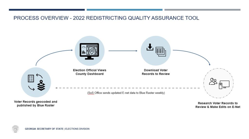
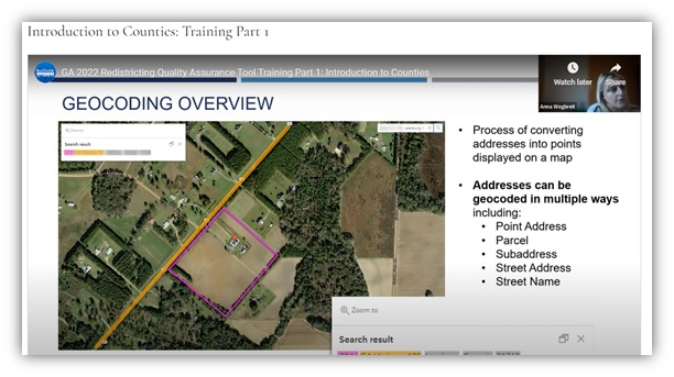
To accomplish the massive task of geocoding nearly 8 million registered voters, Esri and Blue Raster applied the ArcGIS System including ArcGIS Pro on its Amazon Web Services (AWS) cloud environment to process Georgia’s entire voter data file in just a matter of hours. ArcGIS StreetMap Premium allowed for fast and accurate geocoding of addresses to the building and street level. Mapped voters were intersected with new district boundaries to confirm voter assignments. With the process finalized, the team worked quickly to automate it, allowing the voter file to be received each month and fully processed and geocoded within 48 hours to ensure its ongoing accuracy.

Customizing 159+ Dashboards for County and State Election Officials
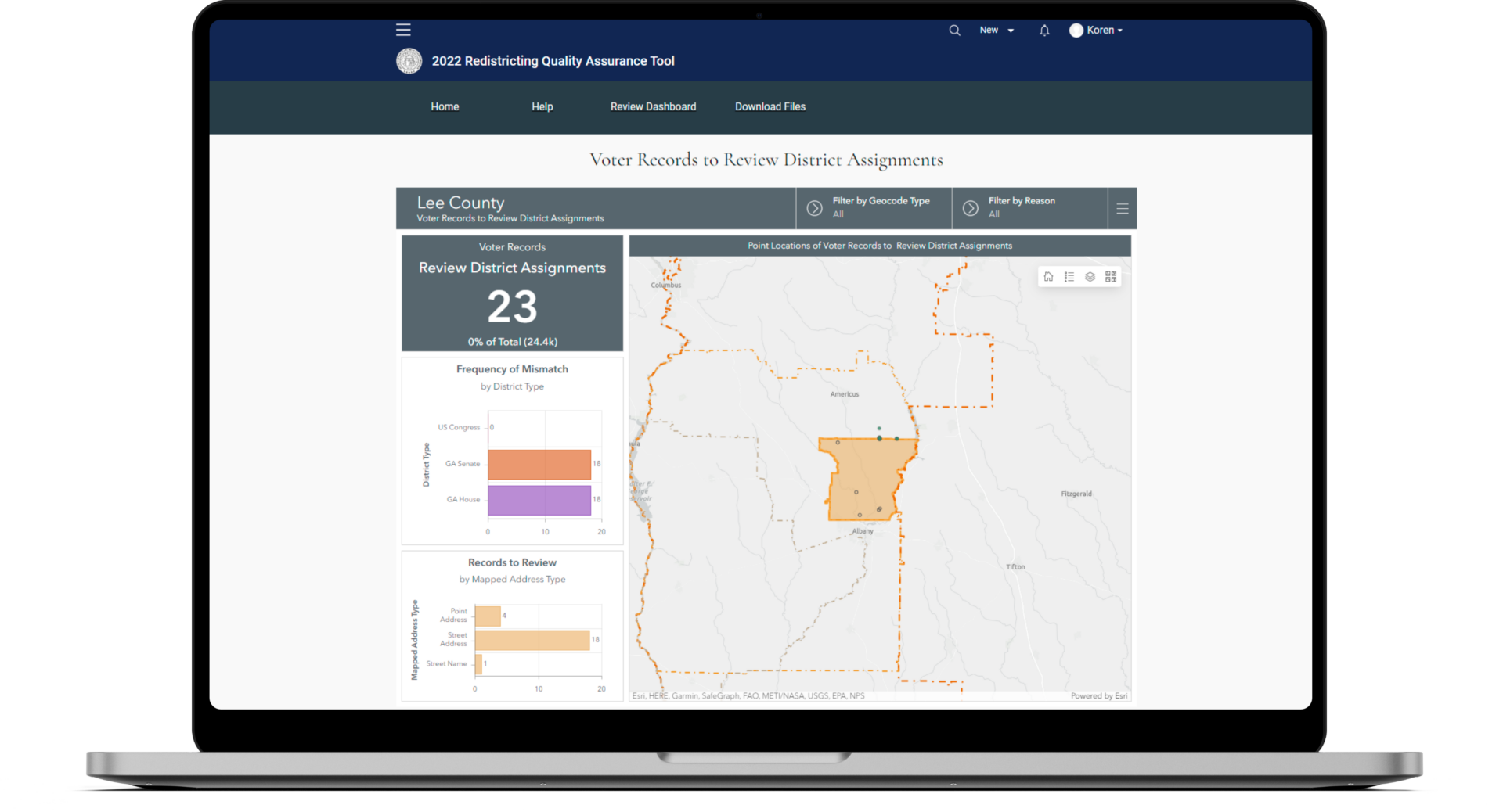
Once a solution was presented for geocoding, Esri and Blue Raster used the Georgia SOS 2022 Redistricting Quality Assurance Tool—an interactive, online mapping resource developed using ArcGIS Hub—to make voter data at the state and county levels accessible to Georgia’s election officials. The innovative tool features:
- A central landing page that is viewable to all users with an account
- Unique ArcGIS Dashboards that are only viewable to their corresponding state or county officials
- 159 automated Hub pages for each county that include instructional information and can only be accessed within officials’ jurisdiction
- Maps of voting districts in officials’ counties and action items they need to address, including any voter records to review
- Voter details—such as where they’re mapped based on the geocoding to confirm the voter is assigned to the correct polling location
- CSV files for voting district assignments that need to be reviewed and for any addresses that could not be placed on the map

By the end of February 2022, Esri and Blue Raster successfully trained Georgia election officials on the 2022 Redistricting Quality Assurance Tool to verify the accuracy of their voter records. The statewide voter record was updated monthly, and geocoded, with updates published to the Hub pages, maps, and reviewable records available within 48 hours. Election officials were reviewing their county Hub pages regularly and reporting back to the Elections Division when updates were made in the voter registration database. This ensured consistent reporting of voter record review progress and official sign-off of completion from Georgia SOS.

Explore Blue Raster’s Elections Services
See how our team can help you make sense of your voter registration files and analyses leading up to the next election—and beyond!
Related Posts
- Blue Raster Pioneering Imagery Management Technology and Delivery Workflows with ArcGIS
- Blue Raster Exhibits and Presents at the 2023 North Carolina ArcGIS Users Group Conference
- Esri ArcGIS Cloud Specialty: Elevating our clients’ GIS capabilities to the sky
- Driving Forward with VDOT’s Integrated Directional Signing Program
- Mekong Monitor – Providing Vital Insight for River-dependent Communities

