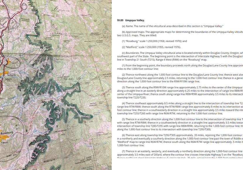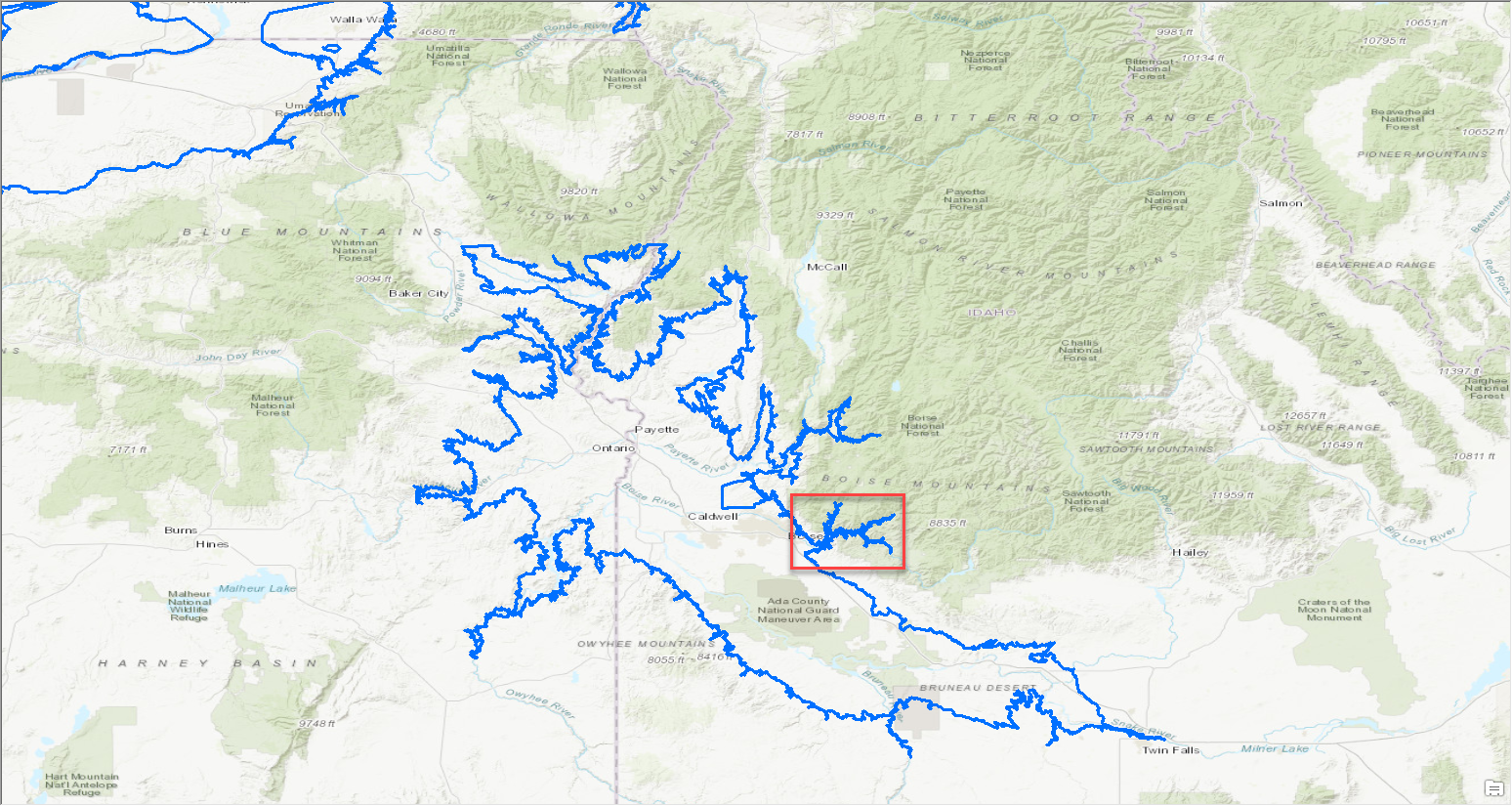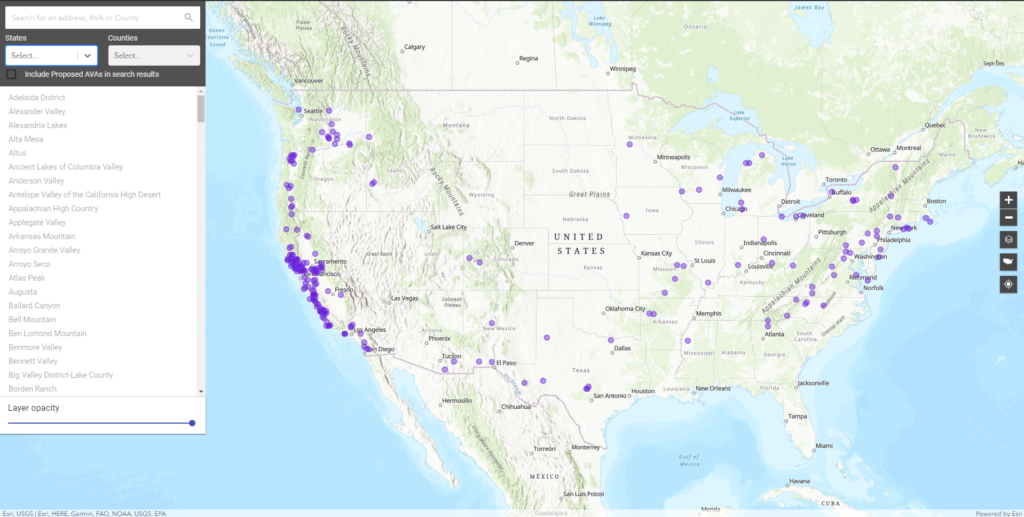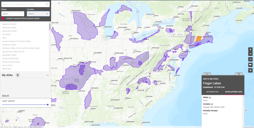
Have you ever wondered where your wine comes from? Did you know that there are hundreds of distinct wine regions in the United States? Since 2017, Blue Raster has been working with the Alcohol and Tobacco Tax and Trade Bureau (TTB) to map over 270 of America’s Viticultural Areas (AVA) in GIS. Blue Raster then developed the AVA Map Explorer, a web mapping application to view, compare and download AVA boundaries.
Viticultural areas are designated grape-growing regions with distinguishable geographic features with boundaries defined by TTB. TTB is part of the U.S. Treasury and overseas regulation and tax collection on the sales of alcohol and tobacco. A map library with thousands of marked-up USGS topographic maps to written boundary instructions called the Code of Federal Regulations (CFR) at 27 CFR Part 9 is the official record and only way to view an AVA.
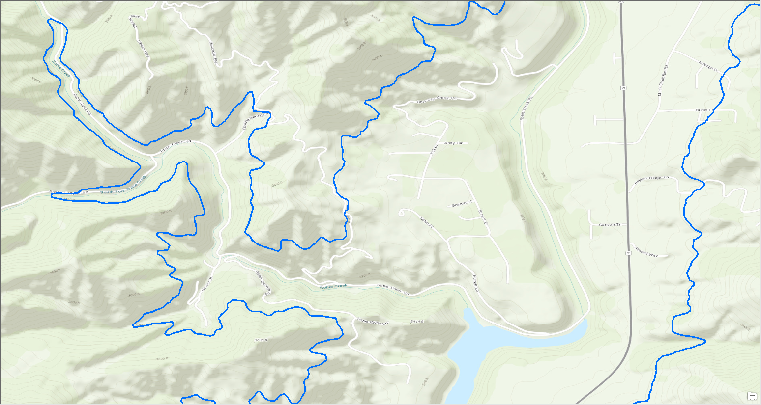
Working with SJ Technologies, the team started the conversion from paper to GIS by creating points for each CFR description in a Viticultural Area. Then, using industry-accepted national datasets including U.S. Census administrative boundaries and roads, and USGS contours and the National Hydrography Dataset, the connected CFR points form viticultural boundaries.
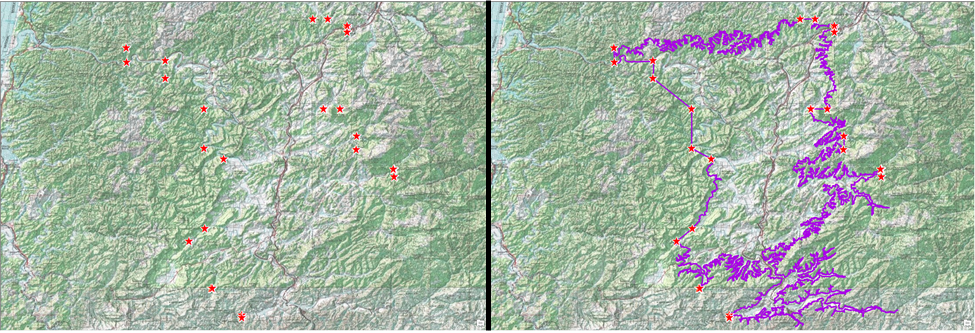
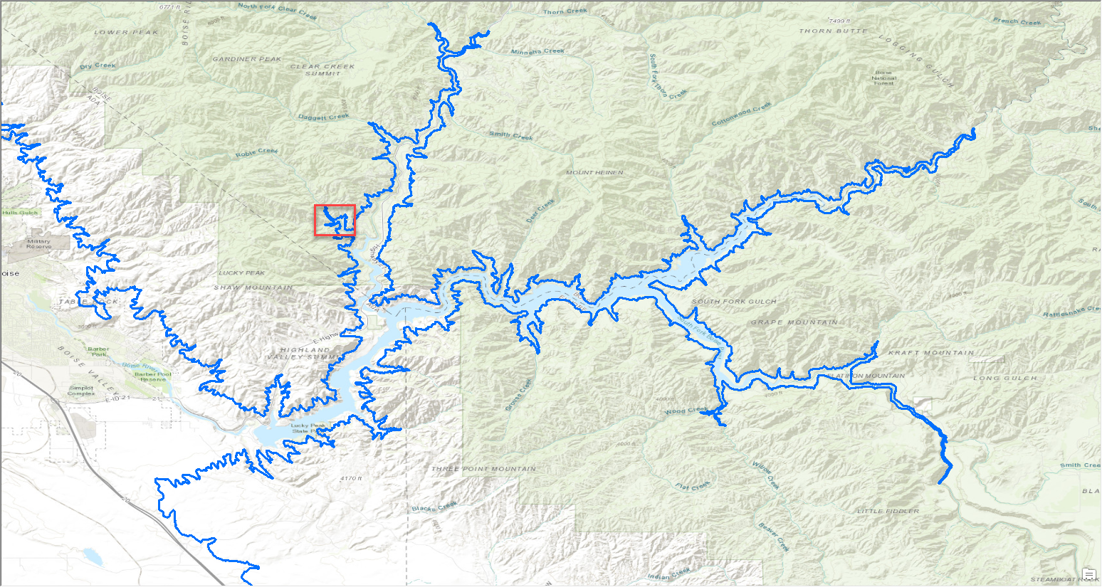
Larger viticultural areas may be drawn on over forty separate paper maps in the maps library. In digital format the number of paper maps is no longer an issue. The new approach allowed for the team to provide an extremely detailed product to TTB that was easily consumable. The ability to zoom in on complex areas or view an entire viticultural area on one screen had previously been impossible.
AVA Map Explorer
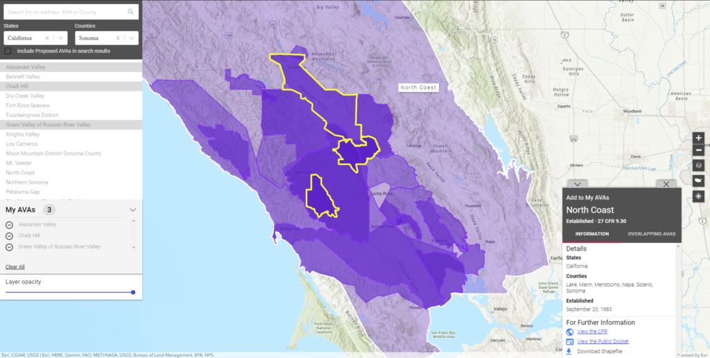
With over 270 AVAs mapped, Blue Raster developed the AVA Map Explorer. This easy to use application helps TTB staff with wine labeling, vineyards petitioning for inclusion in an existing or proposed AVA, and the public to learn more about where their wine comes from. Additionally, users can search AVAs by name, address, State and County filters, or simply by panning around and exploring. Because many AVAs have overlapping boundaries, the ability to compare AVAs was critical. Contained within a popup is information about overlapping AVAs, effective dates, and geographic extent. From the popup users can also link to the CFR, which is still the official record, view the public docket of petitions and rulings, and download the shapefile of the AVA.
Learn more about wine in your area with the American Viticultural Area Map Explorer. Cheers!
Related Posts
- Blue Raster Wins Esri’s StoryMap Challenge
- Blue Raster & Smithsonian Promote Internship Program with ArcGIS StoryMaps
- Modernize your GIS with Blue Raster’s Expert ArcMap to ArcGIS Pro Services
- Transitioning from Web AppBuilder to Experience Builder: Get Ready for a New Experience
- ArcGIS Solutions for Emergency Management Workshop

