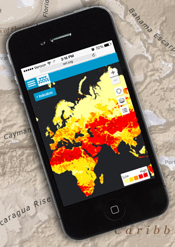
 Earlier today, Blue Raster and the World Resources Institute (WRI) released a new version of Aqueduct Atlas, an application helping companies and investors manage exposure to water risks. Launched in 2013, Aqueduct is used worldwide by leading companies, including McDonald’s, Goldman Sachs, and Procter & Gamble. For the first time, the site is optimized for mobile phones and tablets.
The new site enables users to:
- Assess water stress, supply, and demand in the coming decades
- Learn where water risks will be most severe under well-known climate scenarios
- Prioritize investments for projected conditions
 “The World Resources Institute’s Aqueduct team has worked closely with Blue Raster for over three years developing the Aqueduct Water Risk Atlas. Blue Raster has been an invaluable partner in building innovative mapping tools to meet our target audiences’ needs.”
-Charles Iceland, Director, Aqueduct Project
Features:
- Global water risk maps
- Weighing risk priorities: scarcity, quality, prices, governance, and competition
- Provides industry presets with sector-specific weighting schemes or define your own
- Geocode facilities, suppliers, and potential new market locations
- Export analysis results to Excel
Aqueduct is powered by ArcGIS for Server, ArcGIS JavaScript API, and ArcGIS Desktop. To learn more, visit the platform and see Aqueduct featured in the New York Times, The Guardian, Fast Company, Bloomberg, and Greenbiz.
- Posted in
- Nonprofit/NGO
- Water
