Tag: ArcGIS Online

TrailsMV Mobile Application: Explore Martha’s Vineyard’s Nature Trails

TrailsMV mobile app is the modern day treasure map   

The TrailsMV mobile application is an immersive experience developed by Blue Raster in collaboration with the Sheriff's Meadow Foundation (SMF) and their conservation partners. Designed to cater to hiking enthusiasts, residents, and visitors of Martha's Vineyard, MA, TrailsMV offers an interactive guide to over 220 miles of public trails spread across one hundred protected properties. 

This easy-to-use app allows users to: 

  • browse places to explore through the interactive map 
  • explore Martha's Vineyard trails with confidence through in depth property details 
  • get important alerts about trail closings and guided hikes    
  • learn about the island's rich natural history 
TrailsMV Mobile

TrailsMV provides a comprehensive resource for adventurers through detailed maps, property descriptions, and upcoming event listings. Moreover, users can access curated excursions, informative seasonal articles, and stay informed about upcoming events.

Featured in The New York Times, TrailsMV is an interactive guide to 220+ miles of public trails on more than 100 protected properties across the island of Martha’s Vineyard.

One key feature of the project is the seamless integration of ArcGIS Online data and maps with relevant contextual information, such as photos, text, and directions. Blue Raster developed flexible and repeatable backend workflows to consume dynamic content in the application. Leveraging Survey123 allows the team at Sheriff's Meadow Foundation the power to update, add, or remove content from the app without need for a developer to manually make modifications.

TrailsMV was built using AppStudio for ArcGIS and the ArcGIS Runtime API for Qt (Runtime). With Esri’s recent retirement announcement of ArcGIS AppStudio, Blue Raster will work with Sheriff’s Meadow Foundation on migration options to a new framework.

Incorporating the power of ArcGIS Online, Survey123, and thoughtful design, TrailsMV Mobile Application brings the beauty of Martha's Vineyard's trails to the fingertips of users, empowering them to explore, connect with nature and others, and discover what the island has to offer.

Featured in The New York Times, is an interactive guide to 220+ miles of public trails on more than 100 protected properties across the island of Martha’s Vineyard.

Download TrailsMV Today

Available in the Apple AppStore and the Google Play Store!

Contact Us

  • This field is for validation purposes and should be left unchanged.

Building Bridges to Progress: The Inter-American Development Bank’s HIT Platform for Infrastructure and Transport

Across Latin America and the Caribbean, the Inter-American Development Bank (IDB) plays a pivotal role in financing sustainable, social, economic, and institutional development. With a mission to support transportation and infrastructure projects across South and Central America, the IDB collaborates with various partners to drive positive change in the region.

Blue Raster collaborated with the Inter-American Development Bank (IDB) to develop the Hub de Integracion y Transporte (HIT) Platform, a groundbreaking initiative that serves as a regional infrastructure and transport hub, consolidating and presenting crucial information layers for effective planning and decision-making.

IDB HIT Platform

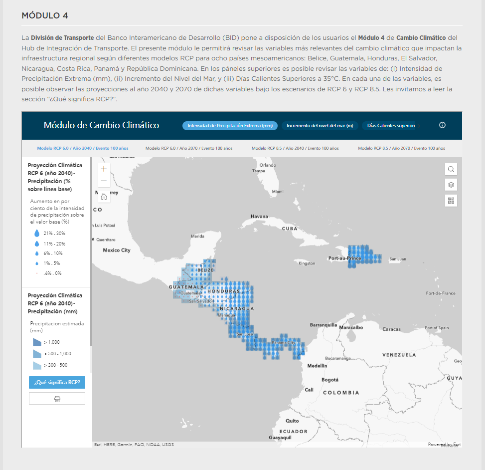
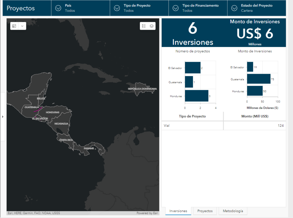
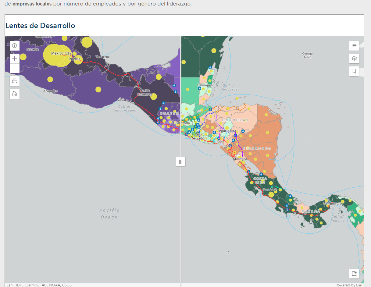
The HIT Platform offers an innovative solution by providing a comprehensive platform that combines key information related to infrastructure, logistics, value chains, projects, climate change, Covid impacts, and development perspectives. This platform acts as a powerful planning tool and an invaluable information repository, catering to the needs of government officials, Mesoamerican stakeholders and IDB specialists. The HIT Project is divided into six modules, each utilizing the robust capabilities of the ArcGIS Online suite of solutions and incorporating custom-developed features to address specific requirements. Recognizing the linguistic diversity of the region, all modules of the HIT Platform were developed in Spanish. The HIT Platform encompasses a series of interactive web applications and dashboards developed with ArcGIS Online and ArcGIS Dashboards.

IDB HIT Platform IDB HIT Platform

The HIT Platform offers a personalized user experience by incorporating customized list and pop-up elements. These interactive components allow users to access specific information related to infrastructure, logistics, and value chains conveniently. By tailoring the user interface to meet specific requirements, the platform enhances usability and efficiency. To enable intuitive data visualization, the HIT platform project utilizes data-driven symbology, a feature within ArcGIS, to dynamically represent information based on various attributes. ArcGIS Arcade expressions, a flexible scripting language within ArcGIS, are employed extensively throughout the HIT project to ensure accurate and consistent data cleaning and formatting. By leveraging Arcade expressions, the platform achieves seamless integration and harmonization of diverse datasets, enhancing data quality and reliability.

Through its effective utilization of ArcGIS Online and its suite of applications and customization options, the HIT Platform sets a benchmark for effective planning and information management in the region, fostering positive change and driving sustainable growth.


Page 3 of 41