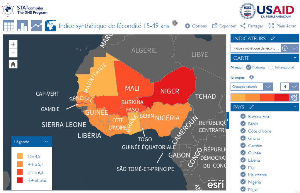
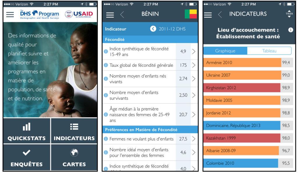
Blue Raster recently had the opportunity to create and present a StoryMap using the new ArcGIS StoryMaps (currently in Beta) for Esri’s “The Magic of Maps: How to Engage and Inspire Your Community” event. At this event, we were able to introduce our own thoughts on the new platform, as well as give advice on how organizations are able to utilize these tools successfully. The StoryMap itself, titled Measuring Success, goes into detail on how some of Blue Raster’s nonprofit partners are tracking progress of the United Nations’ Sustainable Development Goals. It addresses five of the seventeen SDGs and encompasses the work of The Demographic and Health Surveys Program, UNICEF, and The Nature Conservancy.

The Magic of Maps
The presentation focused heavily on how organizations can be successful in the creation and utilization of their StoryMaps, including knowing the target audience, recognizing the potential of a successful StoryMap, and creating a concise and engaging design. Additionally we were able to showcase the features included in the new beta version of ArcGIS StoryMaps. With the new, modern platform users are able to pick and choose distinct elements to piece together, rather than having to select a set template. Uniform text and font size options also help to eliminate the complexity of styles and reduce design workload. Dynamic media types such as maps, videos, and images can be seamlessly integrated into a number of StoryMap features to further engage the audience. Most importantly, the new builder has a simplistic user interface that allows anyone regardless of prior experience (or lack thereof) to produce a professional-caliber StoryMap.
Special thanks to the members of the Blue Raster team who collaborated to create and present this StoryMap: Project Manager Christina Phang, UI/UX Designer Rachel Stock, GIS Intern Kelly Motzko, and GIS Intern Joe Nadonley.
You can view the slides and listen to the presentation here.