Our Work

Blue Raster helps you tell your story through interactive
mapping technology. Make your message clear, exciting,
and user-friendly for both mobile and web platforms.

Tag: US National Arboretum

Public Gardens on Display in Washington, DC

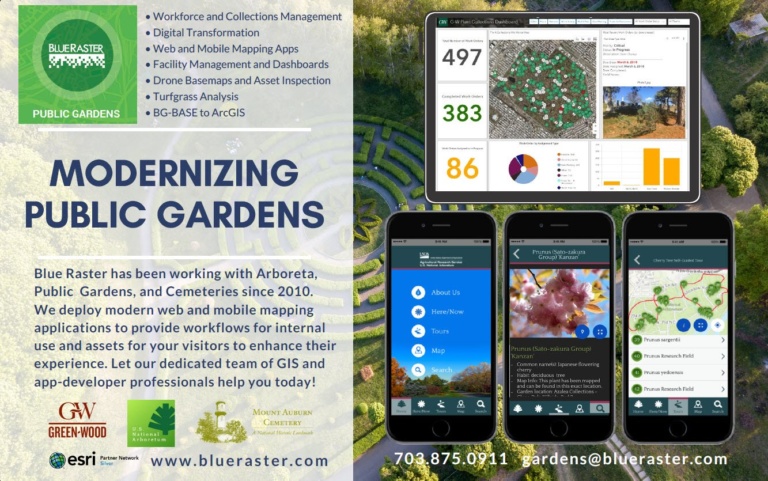
Last month, over 1,000 public horticulture enthusiasts attended the American Public Gardens Association annual conference in Washington, DC. Blue Raster was proud to be a conference sponsor and presenter at the GIS for Public Gardens: Enterprise Configurations workshop. Christopher Gabris, Blue Raster's Project Manager for Public Gardens, was pleased to show our recent work in the community including:

The conference included a walking tour of the Smithsonian and U.S. Botanical Gardens on the National Mall. Also, it featured an evening at U.S. National Arboretum with a Tour and Reception.

Blue Raster is continuing to serve public gardens in their mission to be inclusive for all and indispensable to the community. You can learn more about our capabilities and ongoing projects at https://www.blueraster.com/gardens/.

Ready to find out more?

Contact us today to get started on your next project!

Going Mobile at U.S. National Arboretum!

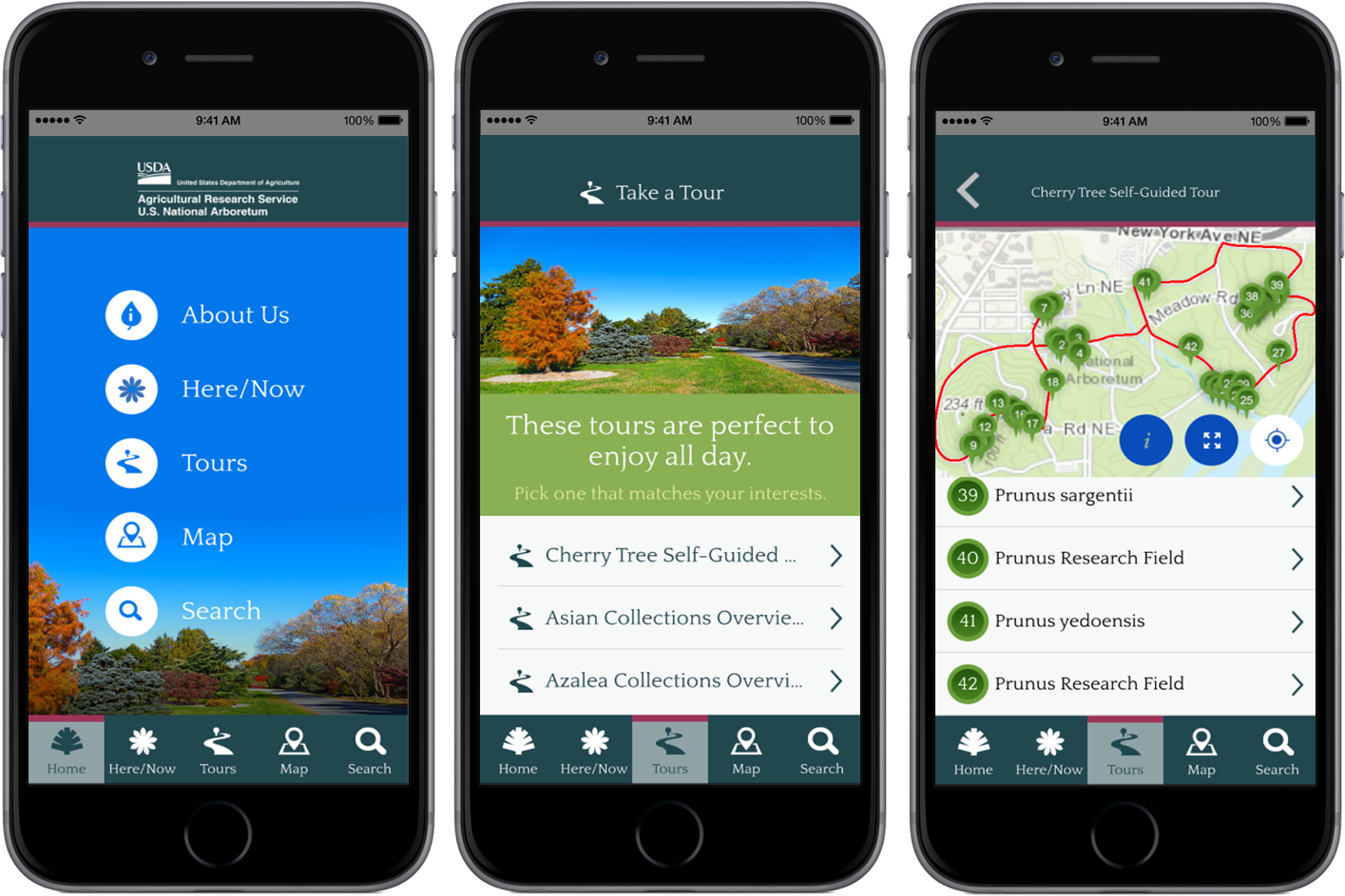
Blue Raster developed and launched a new mobile application for The United States National Arboretum, giving scientists and visitors a unique experience and new way of exploring the research grounds. The National Arboretum is a division of USDA’s Agricultural Research Service (ARS), the main in-house research arm of USDA. This mobile app for Apple and Android builds off of the online Botanical Explorer tool (ABE) released in 2012.

One of Washington, D.C’s hidden treasures, the National Arboretum receives over 500,000 visitors annually. Covering over 440 acres and 9.5 miles of roads, this public garden is a living museum and center for major botanical research and public education.

Built using Esri’s AppStudio for ArcGIS, the application is available for free download in the iTunes and Google Play stores.

Arboretum Mobile app

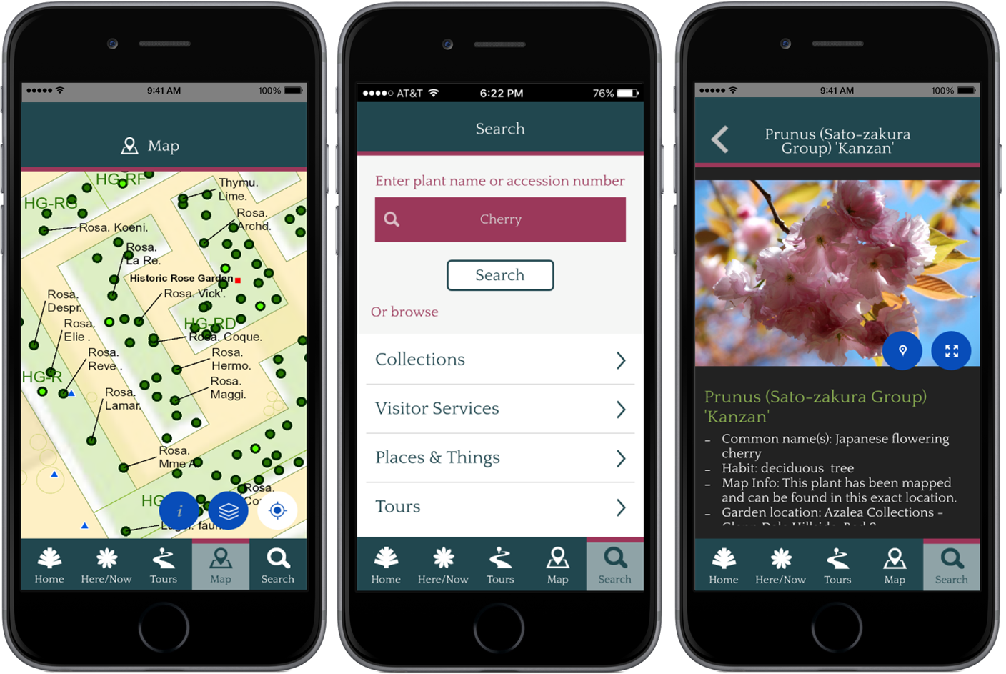
The mobile app allows users to locate themselves on the grounds, easily find information about ongoing exhibits, as well as locate visitor services such as parking, restrooms and water fountains. Roam the grounds freely or take advantage of many pre-defined tours sized just right for the time you have, complete with individual stops, photos and descriptions.

For those looking to dig even deeper, individual plants records are displayed on the map and searchable by Name or Accession Number, and extensive scientific data are included for much of the collection.

Arboretum Mobile app

Whether an avid explorer, a researcher or a first-time visitor, this interactive mobile application goes beyond the paper map to offer a unique experience for all users to investigate and learn more about the Arboretum than ever before.


Page 1 of 2