Lovin Contracting is responsible for maintaining the landscaping around many of Georgia’s state routes and interstate highways. As part of their contract with the Georgia Department of Transportation (GDOT), they needed a digital reporting system for required auditing of their work. Additionally, the system needed to be easy to use for three distinct user groups – employees in the field doing the maintenance, managers at the Lovin Contracting office overseeing the teams, and the GDOT employees that manage the landscape and maintenance contract.

Blue Raster built the Work Locations Tool to meet the specific needs of this multi-stakeholder process. The Work Locations Tool replaced manual processes that saw field teams taking paper maps and lists to work sites and then delivering paper forms back to the office as records of their work.
The first step in developing the solution was to digitize all of the location information from paper and formatting it to make it GIS friendly. Once the data was in the right format, the next step was to visualize the data on a web map.
Work Location Tool Field Application
Teams in the field use the ArcGIS Field Maps app as well as the Survey123 for ArcGIS on mobile devices. Within these applications they can record where they are with location information auto-populated and fill out the necessary information about the type of work they are completing. In addition, they can record where in the cycle of maintenance they are, and can even upload before and after photos to show progress. All of this information is uploaded to systems back at the office.

Home Office Dashboard
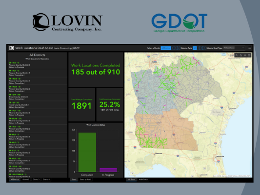
Management dashboards allow for the Lovin team to see the status of all of their areas of responsibility. They can filter information by location as well as cycle of work. They can view total miles completed in a certain time period. In creating maps, Blue Raster could not default to using mile marker data as Lovin defines areas of responsibility differently. Thanks to Esri Model Builder, the display of the maps match how the work was reported and assigned. As they collect more data, this information helps Lovin better allocate teams and equipment to increase efficiency.

Department of Transportation Audit View
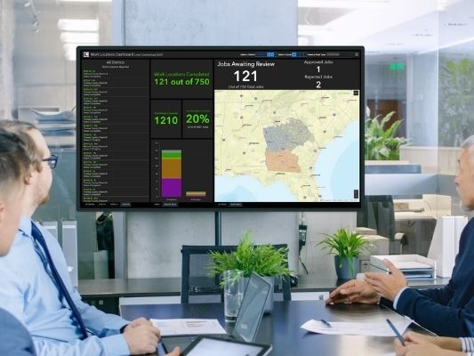
The driving force for this project was the DOT’s need to be able to quickly audit work to ensure compliance with the contract and confirm proper payment. With the system, GDOT officials can log in to see the status of contracted work. The GDOT is granted access to only the data they need for their audits.
Cultivating the Digital Landscape
This move to online reporting is a huge culture shift for the Lovin team. As the Work Locations Tool goes live, Blue Raster is working with all user groups to train them on the new technology and workflow to ensure they immediately see the efficiency benefits of moving reporting online.
Related Posts
- Integrating Field GIS at Green-Wood Cemetery
- Driving Forward with VDOT’s Integrated Directional Signing Program
- Public Gardens on Display in Washington, DC
- Disposal of Debris after Disaster: Blue Raster partners with CDR Maguire to quantify and monitor disposal of debris material
- Field Trial Success: Farming Sustainability With Esri Collector and ArcGIS Online
