New Resource in Time for World Water Day!
World Water Day is celebrated on March 22 to raise awareness of and to inspire action to tackle water and sanitation issues globally.
Blue Raster, with leadership from and in close collaboration with The DHS Program, has developed the Local Data Mapping tool, debuting today on the DHS Program Spatial Data Repository(SDR).
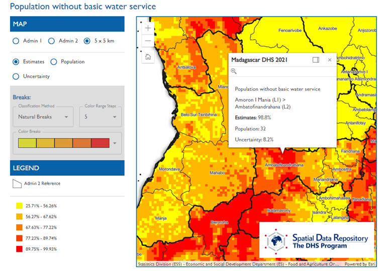
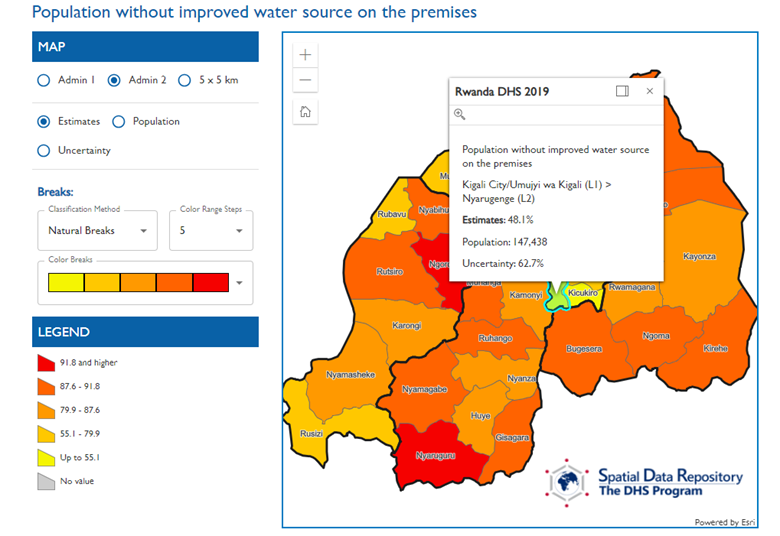
Just in time for World Water Day, the tool features new visualizations for four WASH (water, sanitation and hygiene) indicators disaggregated to a more granular level then previously available and in both vector and raster format! Browse to the new page here: https://spatialdata.dhsprogram.com/local-data-mapping-tool/
To visualize:
- Administrative Area Level 2 in vector format
- Raster images at a 5 x 5 KM resolution
- Traditional Administrative Area 1 disaggregation

Viewing and interacting with raster data on a map is an entirely new offering for the USAID funded DHS Program. The 5 x 5 KM raster layers are stored on Esri ArcGIS Enterprise and accessed using the ArcGIS SDK for JavaScript. Raster and vector data are processed and published using the powerful ArcGIS Pro desktop software. Blue Raster’s Bojan Zivkovic and Chris Messerich tightly integrated with Dr. Ben Mayala and Dr. Rose Donohue from the DHS Program GIS team to make sure the data and application was developed to the requirements from USAID.

Blue Raster and The DHS Program have a successful 15 year partnership and the venerable Spatial Data Repository has served GIS data to the public for over 10 years. We love seeing this workhorse tool getting updated and adapted to more and more uses. It's perfect for viewing water indicators for World Water Day! Visit spatialdata.dhsprogram.com today!
Related Posts
- New Updates to The DHS Program Spatial Data Repository: A one stop shop for Spatial Analysis Datasets
- Answering the Call for More Sustainable Groundwater Management with GRAT
- Watersheds New Release for EPA
- Advancing Sustainable Development in West Africa: A Geospatial Toolkit for Monitoring SDG Goals
- Bringing Transparency to Transboundary Water Policy in the Mekong River Basin
