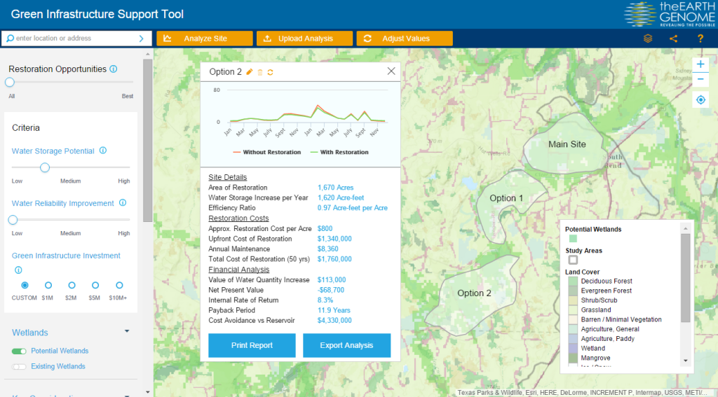
Water is one of the world’s most pressing challenges. Faced with the opportunity to find better water solutions for global stakeholders, the Earth Genome, backed by the World Business Council for Sustainable Development (WBCSD), enlisted the help of Blue Raster and Arizona State University to create the Green Infrastructure Support Tool (GIST). The interactive web mapping application provides high-level wetland-restoration site analysis and portfolio prioritization to address water scarcity and was recently launched at GreenBiz 2016.
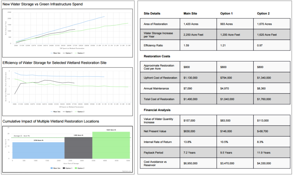
The tool employs criteria-based screening via spatial data and end-user inputs, enabling end users to weigh options across the region and compare relative value and costs. Financial metrics include net present value, area cost curves, and environmental return on investment. Together, they help determine the best “bang for buck” restoration sites to provision water across an entire basin. The application combines environmental data such as wetland areas, biodiversity and land cover with business initiatives that consider both investment and costs for various land-cover restoration options, resulting in a truly spatial decision support system.
Key in the development of GIST was the ability to present data in an easy-to-use way and to incorporate millions of points of disparate environmental data. As a result, corporations, governments, water authorities, resource engineers or anyone interested in potential water restoration are able to create their own development sites with corresponding financial analysis. The reporting engine supports comparing multiple sites, determining the optimal green infrastructure investment, based on landscape characteristics and hydrologic modeling.
The ability to create these custom reports is made possible by on-the-fly statistical/histogram calculations leveraging the ArcGIS Image Server extension. The GIST also uses the ArcGIS JavaScript API and Highcharts to supply the data and charting throughout the application.
“Blue Raster was a terrific partner. The Earth Genome exists to unite data, science, visualization and end users to solve some of the planet’s most wicked problems. Blue Raster was essential in pulling off GIST, what we believe is a breakthrough tool that puts environmental data, translated via world class science, into the hands of real decision makers. I’m most pleased with the work Blue Raster did on the visual interface. The tool is elegant yet simple: anybody can use it to find the opportunities that make most financial sense for their organization.”
Related Posts
- Track Industrial Spaces in the Mekong Region with the Updated Mekong Infrastructure Tracker
- Mekong Infrastructure Tracker
- Answering the Call for More Sustainable Groundwater Management with GRAT
- Bringing Transparency to Transboundary Water Policy in the Mekong River Basin
- Solving the Water Balance Equation for California


