Tag: Cemetery

Using Drones to Advance Turfgrass Science at Green-Wood Cemetery

Last month, Blue Raster’s drone capabilities took flight. In a new initiative with Green-Wood Cemetery, Cornell University, and a group of turfgrass experts from across the United States, Blue Raster is using drones to help advance the science for confronting climate change in an urban landscape.

The issue at hand is the rapid spread of warm-season invasive grass species that impacts the aesthetics of the cemetery. This results in adaptive preventative maintenance practices and high costs to keep the cemetery looking beautiful. The group is studying alternatives and strategies that put Green-Wood on the cutting edge of urban climate change mitigation. This research is also applicable to any urban parks, public gardens, cemeteries and golf courses.

"Turf Guy" Dr. Frank Rossi of the School of Integrative Plant Science at Cornell University and Christopher Gabris from Blue Raster looking at high resolution drone imagery captured the day before

“Turf Guy” Dr. Frank Rossi of the School of Integrative Plant Science at Cornell University and Christopher Gabris from Blue Raster looking at high resolution drone imagery captured the day before

To study the spread of invasive grass throughout the year, Blue Raster flew a series of drone missions over the sprawling 478 acre cemetery. When additional missions fly for comparison, the data capture will provide high quality imagery that will identify invasive grass for measurement and monitoring throughout the year. Visit our Facebook album for more of the amazing aerial pictures.

Green-wood drone pictures

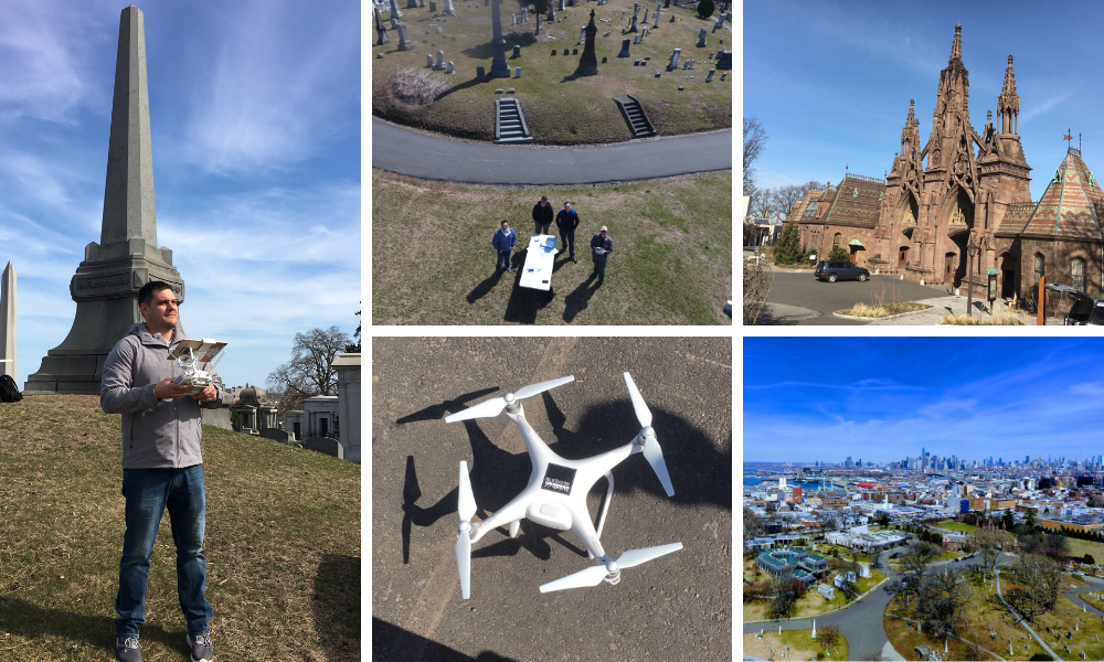
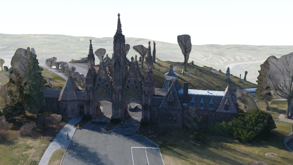
Using Esri’s Drone2Map and ArcGIS Online Web Scenes, Blue Raster was also able to deliver some 3D products, including the iconic gateway entrance and some large mausoleums.

Drone 3D imagery of iconic entrance

Stay tuned for updates on the project, the analysis, and the results of this very exciting turfgrass study!

Blue Raster attends the American Public Gardens Association Annual Conference

Blue Raster works with multiple public gardens and arboreta to develop web and mobile applications. These apps help to interactively map robust plant collections for the public, and provide workflows for internal facility and maintenance teams to work more efficiently.

This June, Blue Raster was a presenter at the American Public Gardens Association’s annual conference. Presenting alongside the Alliance for Public Gardens GIS, the presentation focused on Enterprise Configurations and GIS solutions for public gardens. Blue Raster was proud to present our recent work with the U.S. National Arboretum and the development of their mobile application, as well as automated field mobility workflows for plant maintenance and monument restoration tasks at Green-Wood Cemetery.

APGA Conference photo

APGA Conference photo

Hosted at the Disneyland Hotel in Southern California, the conference was a great opportunity to see how public gardens across the world are uniquely attracting visitors, storing their plant data and historic records, and collaborating with each other. A special behind-the-scenes tour with Disneyland arborists and a trip to The Getty Museum in Los Angeles were just some of the amazing events during the week.

Is your garden interested in mapping your plant collections? Do you want to take your visitor experience to the next level with a mobile application? Blue Raster is experienced with plant data and workflows. Each project is custom-designed to fit your specific needs. Learn more about our workflows how we can help you.

APGA Conference photo


Page 3 of 4