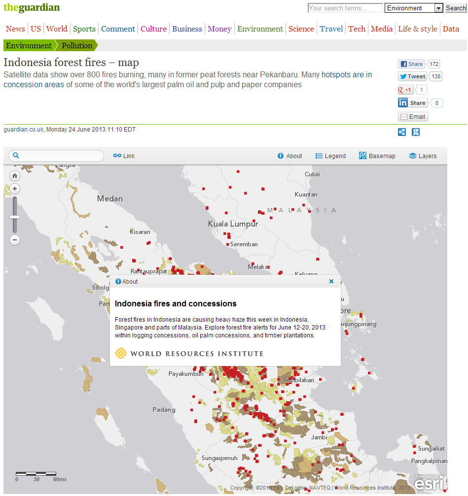
Environmental restoration is becoming a top priority for many countries around the world, but it can be difficult to synthesize the numerous sources of information available to make decisions about where this restoration should happen. With the new GFW Map Builder template, anyone can create an online map application visualizing and analyzing their data alongside local, regional, or global land use data to identify future restoration priorities.
Blue Raster created Map Builder, a configurable ArcGIS Online template, for the World Resource Institute’s Global Forest Watch (GFW) program. The template allows users to overlay their own datasets, such as endangered species habitats, commercial concessions, or national protected areas, with GFW land cover and land cover change data in order to pinpoint the best locations to focus restoration efforts. The template provides built-in metadata and analysis tabs, which viewers can use to learn more about specific features in the map and generate reports with a variety of analyses on any feature.
Many users are already taking advantage of Map Builder’s impressive capabilities to create their own customized map applications. For example, Kenya’s Ministry of Environment and Natural Resources recently completed a national restoration opportunity assessment informed by their Tree-based Landscape Restoration Potential Atlas created using the Map Builder template. The atlas overlays rivers, land use, and population density with areas marked as having potential for restoration. Check out blog posts by Thomas Maschler and Asa Strong from World Resources Institute about customizing GFW and open data and GIS for more information and examples.
Built with ArcGIS API for JavaScript, Map Builder leverages ArcGIS Online templates as well as the ArcGIS for Server Image Extension for analysis. It features lightweight code with a fully mobile and responsive design, making it accessible even in countries with low bandwidth.

“Mapbuilder allows users to combine GFW’s geospatial analysis features with data that is important to their local cause and environment. With this highly-customizable tool users can now build web applications to monitor forests in their own backyard. Park rangers can track where forests were cut down as recently as a week ago, auditors can calculate countries’ carbon emissions from forest conversion and companies can find and address points in their supply chains that contribute to deforestation. WRI uses Mapbuilder as a platform for Forest and Restoration Atlases. These applications are published and updated together with partnering national government agencies. The tight integration with ArcGIS online allows our country teams to manage their sites independently and reduces the amount of necessary training and follow up support.“
-Thomas Maschler, GIS Manager for GFW Africa, World Resources Institute

