Tag: Responsive Design

APTA Story Map Amplifies Advocacy Message

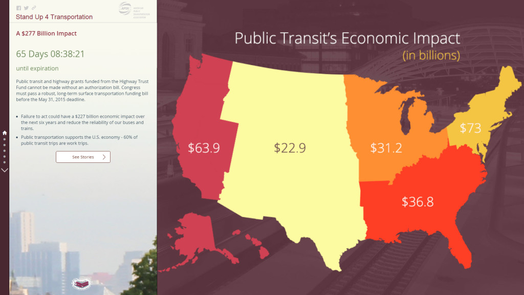
APTA Story Map - Stand Up 4 Transportation

The American Public Transportation Association (APTA) asked Blue Raster to create a story map to spread their message. According to APTA, public transit saw its highest ridership in 58 years at 10.8 billion trips, but the current federal funding bill is set to expire on May 31, 2015.

Although a long-term transportation bill is supported by the transportation industry in near unanimity, APTA wanted a way to connect their message with constituents and to broadcast it out to a wide audience.

The Stand Up 4 Transportation story map features first-person narratives describing how public transit is impacting people in all parts of the country and sectors of the economy. The story map strategically launched in coordination with national Stand Up For Transportation Day on April 9th, a keystone event for showing national bill support.

Story from Minneapolis, MN

The map provides users with quick data visualization and offers information important at the community level including:

  • Transportation funding
  • Manufacturing Jobs
  • Rail and bus services

The ability to share the map on social media enabled APTA to amplify their message. Launching the application helped propel #SU4T on Twitter, Facebook, and other social media. By using maps, APTA was able to show the scale and impact of public transit, in a new way that text could not.

#SU4T

View the Stand Up 4 Transportation story map and see for yourself how your story can get in front of Congress and decision makers.

Development Alert! Awareness of Infrastructure Projects

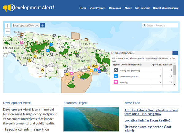
The World Resources Institute (WRI) and the Jamaica Environment Trust (JET) announced today the launch of the newest tool from WRI’s Access initiative, Development Alert!. Built by Blue Raster, the free, mobile-friendly site provides the public with greater access to information about development projects affecting the environment and public health. The site plots approved and proposed large-scale development projects along with overlays of protected areas, fisheries, forest reserves and land cover so users can easily identify projects in or around environmentally sensitive areas.

Development Alert Homepage


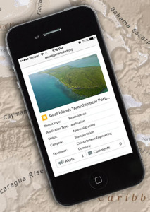
Development-Alert-On-iPhone-Map

In Jamaica, Development Alert! is helping promote transparency and public involvement in projects including the trans-shipment port in Goat Islands. The project is expected to flatten the Goat Islands to develop a $1.5 billion trans-shipment port.

Using the map of Jamaica in Development Alert!, members of the public can see that this project is not only located in a protected area but is also within a forest reserve and Special Fisheries Conservation Area.

See the Goat Islands Project in Action.


Carole Excell, Project Director, The Access Initiative“The dynamic new website Development Alert! Jamaica is the result of a close collaborative approach with Blue Raster. What has been accomplished is an innovative new advocacy tool for environmental defenders. It’s a first not only in Jamaica but in the entire Caribbean. We could not have asked for better partners in this project and hope to bring this website to other countries around the world.”

Carole Excell, Project Director of The Access Initiative at WRI


The site is developed on WordPress for easy content management by JET, and is integrated with ArcGIS Online and ArcGIS Server via the JavaScript API for mapping capabilities. Learn more and visit Development Alert!.


Page 4 of 6