MapED is a primary source of geographic education and demographic data for students across the U.S.. The latest MapED launch brings exceptional updates to this platform both technically with the introduction of several new maps and visually in the redesign. The National Center for Education Statistics (NCES), Education Demographic and Geographic Estimates (EDGE), Sanametrix, and Blue Raster all brought unique expertise to ensure that any student, parent, or education professional has access to compelling and up-to-date maps and data.

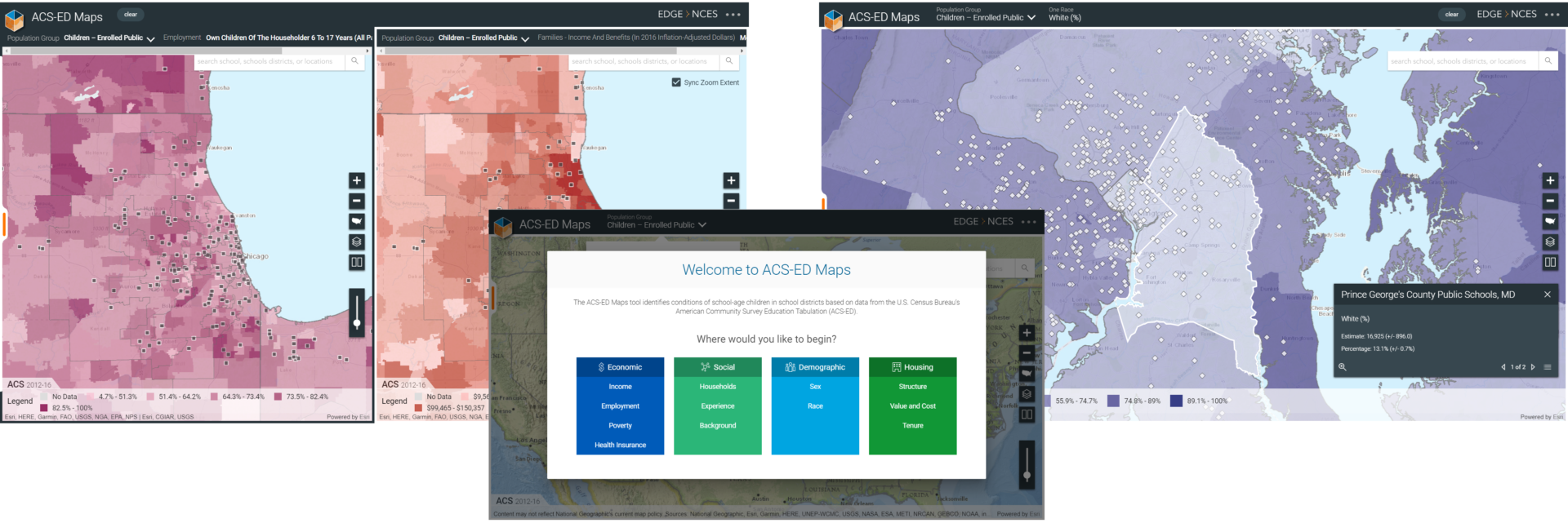
ACS-ED Maps
The ACS-ED Maps application is the latest exploratory tool to identify conditions of school-age children in school districts across the United States. Users can explore indicators such as poverty, health insurance coverage, and race to better understand the connections between students, school districts and their surroundings.
“The Census Bureau creates the ACS-ED custom tabulation for the NCES EDGE program to help measure social and economic conditions of school-age kids in local school districts. Those conditions can vary considerably across different parts of the U.S. and even within the same metropolitan area, so the goal of the ACS-ED Maps tool is to help people visualize school district socioeconomic conditions in their geographic context so they can better understand how location affects education.” – Doug Geverdt, Administrative Data Division, NCES

ACS-ED Map is updated annually with the latest data available from the U.S. Census Bureau. Browse indicators by total population or get more refined data for school-age children by narrowing the search to all children, children enrolled in any type of schooling, or children enrolled in public school.
ACS-ED maps support side-by-side comparison of indicators by allowing users to create two views within the same browser. Additionally, users can share out their map on Facebook, Email or Twitter. The application utilizes ArcGIS Server and the ArcGIS API for JavaScript.
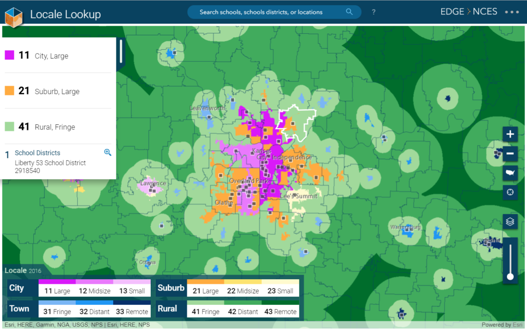
Locale Lookup
The Locale Lookup application identifies the types of communities where schools are located. Explore Public Schools and School Districts from the Common Core of Data (CCD), Private Schools from the Private School Survey (PSS), and Post-Secondary Schools from the Integrated Post-secondary Education Data System (IPEDS) in relation to their Locale classification, from rural to city landscapes. The application utilizes ArcGIS Server and the ArcGIS API for JavaScript.