Tag: biodiversity

Three Compelling Story Maps for Agriculture Risk

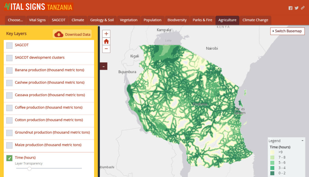
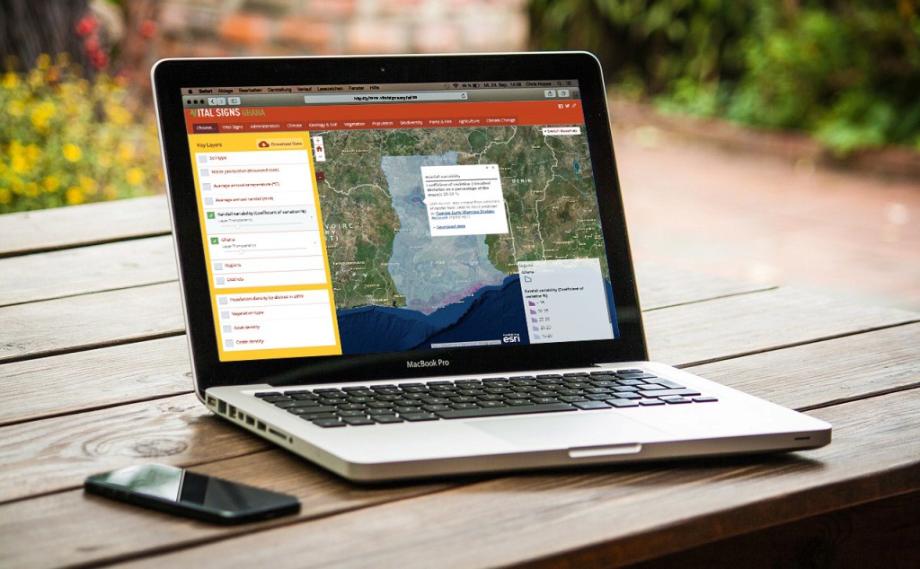
We worked with Conservation International to upgrade their Vital Signs mapping applications. Using the Esri story map series template, we customized, optimized, and styled the atlases to reflect the mission and spirit of Vital Signs.

Vital Signs - Ghana Atlas

Designed to provide risk management tools for agricultural development, the atlases feature new functionality including the ability to:

  • Re-order layers
  • Adjust transparency
  • Download datasets
  • Share the maps on social media

“These atlases will enable planners and managers in Africa, who do not have GIS skills, to manipulate and overlay different data layers for planning and also provide access to relevant data from a wide variety of sources and sectors.”

Sandy Andelman, Ph.D., Senior Vice President and Chief Scientist at Conservation International


The atlases provide a baseline and a synthesis of existing data on agriculture, ecosystems, and human well-being, on which Vital Signs is building. They also enable anyone to visualize where Vital Signs is collecting data, in the context of what is already known.

Vital Signs - Tanzania Atlas


“Blue Raster helped our team optimize Vital Signs’s Online Interactive Atlases and add user-friendly functionality. They understood our needs and lent the support our team needed in the critical months before release.” 

Kellee Koenig, GIS Manager at Conservation International


Blue Raster leveraged ArcGIS Online and ArcGIS desktop to build the atlases. Visit the site, and see how Blue Raster helped Conservation International leverage and customize a current Esri Story Map framework to provide three compelling risk management tools for the agriculture industry.

NFWF maps 12K Conservation Grants with ArcGIS

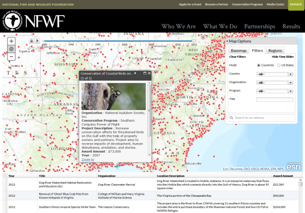
To help illustrate the extensive geographic reach of their mission and impact of their conservation programs, Blue Raster built the Where We Work web map for the National Fish and Wildlife Foundation (NFWF). The mapping application allows supporters to visualize where NFWF is working and learn more about individual grants of interest. Matt Foster, Monitoring and Biodiversity Officer at NFWF, has this to say about the map – “The interactive map showing NFWF projects over the past 30 years is a great asset.  It really helps to convey the breadth of NFWF work in the U.S. and around the world and describes the wide range of actions that we support.”

NFWF Grant Mapper

Built on ArcGIS for Server using the ArcGIS API for JavaScript, NFWF’s Where We Work map allows filtering based on time, location, and various other grant attributes including the associated conservation program. The Flickr API provides images for the various projects.

The National Fish and Wildlife Foundation (NFWF) is a Congressionally-chartered foundation, specifically charged with the administration of monies to “further the conservation and management of fish, wildlife, plants, and other natural resources” of the United States (National Fish and Wildlife Foundation Establishment Act, 16 U.S.C. §3701 et seq.). Since 1984, NFWF has become one of the world’s largest conservation grant-makers with more than 12,100 grants totaling over $2.1 billion.


Page 3 of 6