The World Resources Institute (WRI) and the Jamaica Environment Trust (JET) announced today the launch of the newest tool from WRI’s Access initiative, Development Alert!. Built by Blue Raster, the free, mobile-friendly site provides the public with greater access to information about development projects affecting the environment and public health. The site plots approved and proposed large-scale development projects along with overlays of protected areas, fisheries, forest reserves and land cover so users can easily identify projects in or around environmentally sensitive areas.
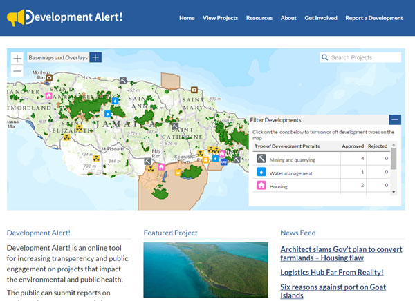
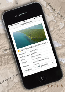
In Jamaica, Development Alert! is helping promote transparency and public involvement in projects including the trans-shipment port in Goat Islands. The project is expected to flatten the Goat Islands to develop a $1.5 billion trans-shipment port.
Using the map of Jamaica in Development Alert!, members of the public can see that this project is not only located in a protected area but is also within a forest reserve and Special Fisheries Conservation Area.
See the Goat Islands Project in Action.
 “The dynamic new website Development Alert! Jamaica is the result of a close collaborative approach with Blue Raster. What has been accomplished is an innovative new advocacy tool for environmental defenders. It’s a first not only in Jamaica but in the entire Caribbean. We could not have asked for better partners in this project and hope to bring this website to other countries around the world.”
Carole Excell, Project Director of The Access Initiative at WRI
The site is developed on WordPress for easy content management by JET, and is integrated with ArcGIS Online and ArcGIS Server via the JavaScript API for mapping capabilities. Learn more and visit Development Alert!.
- Posted in
- Environment
- Nonprofit/NGO