Our Work

Blue Raster helps you tell your story through interactive
mapping technology. Make your message clear, exciting,
and user-friendly for both mobile and web platforms.

Tag: MODIS

Global Fires Analyzed by Country

Produced in partnership with the World Resources Institute, the recently updated Global Forest Watch Fires (GFW Fires) is an online platform for monitoring and responding to forest and land fires using near-real-time information. GFW Fires empowers people to better respond to harmful fires before they burn out of control, holding accountable those who may have burned forests illegally.

With the most recent release of GFW Fires, users can explore fire events for every country around the world over the last five years — using two sensor products: VIIRS and MODIS. Fire history, cumulative fires to date, and a statistical analysis by administrative boundaries allow great insight into fire events within a country or around the world.

Fire Report for Tanzania

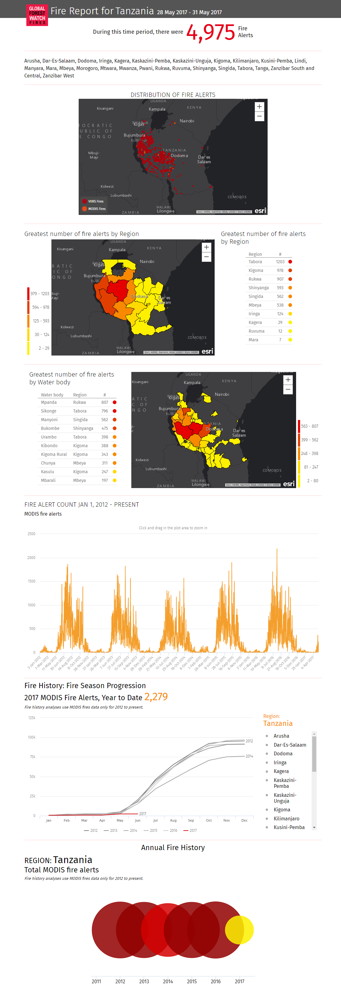
Be sure to check out your country of interest at GFW Fires, and see how technology is harnessed to address a major global concern.


Fires in Indonesia Park seen with GFW Fires App

The World Resources Institute’s (WRI) Global Forest Watch Fires is currently being used to respond to a massive outbreak of fires in Tesso Nilo National Park, Indonesia. The fires in the protected area began May 29, 2015 and have continued to burn since.

In response, Blue Raster created the maps below using ArcGIS Online and a custom application to analyze the region where fires are burning. Using 50 centimeter resolution imagery along with NASA MODIS fire data, the maps capture the illegal activity occurring within the boundaries of this protected land. GFW Fires continues to be used as a response tool in Tesso Nilo and other parts of the world.

Check out the maps, and visit GFW Fires to see the latest on this outbreak.

Fires in Tesso Nilo National Park


Page 1 of 2