Modern Solutions for Addressing Today’s Public Health Challenges
The American Academy of Family Physicians (AAFP) aims to strengthen family physicians and the communities they care for through prevention and public health initiatives. As part of this effort, their innovation arm, HealthLandscape, develops geospatial data visualization to help the community find insights to improve health care.
Zeroing in on Community Health Demographics
Blue Raster has been working with the organization for over a decade, creating and modernizing GIS solutions. Recently, the team moved the Community Data Portal from Flash to Java Script.
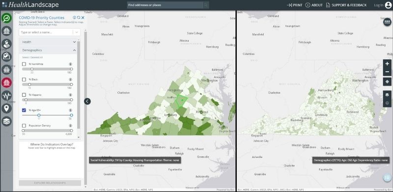
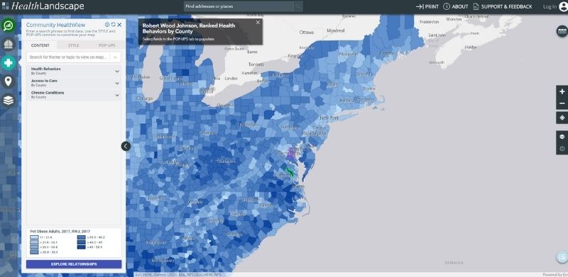
Using this portal, health providers and public health officials can filter the data most important to their communities and their area of practice. The configurable tool enables users to explore demographic, education, income, and health disparities and can be configured for any geographic area. The tool can ingest datasets from sources like the U.S. Census Bureau, the Appalachian Regional Commission, the Robert Wood Johnson County Health Rankings, Centers for Medicare & Medicaid…the possibilities are endless. Users can create side-by-side maps between indicators (for example, diabetes and poverty) to visualize potential relationships. Additionally, users can overlay infrastructure data such as interstate networks or locations of health facilities and start to visualize patterns between the two. Graphs and charts are available to see the numbers behind the data and reports can be automatically run off the filters. The solution uses Esri ArcGIS API for JavaScript, Node, React, and ArcGIS Enterprise and Portal for ArcGIS.

Meeting the Demands of High Risk Populations
Similarly, Blue Raster developed the Local Needs Assessment application that helps identify high-risk areas based on social determinants of health (“cold spots”) and poor health outcomes (“hot spots”). Identifying and mapping these high-risk areas allows for targeted approaches. The solution allows users to explore relationships between these two and identify outliers by creating scatter plots. In addition, users can customize this solution to examine childhood health, geographic population health, mental health and more public health indicators.


Health organizations are developing innovative ways to harness the data integration and spatial visualization power of GIS.
GIS plays a critical role in determining where and when to intervene, improving the quality of care, increasing accessibility of service, finding more cost-effective delivery modes, and preserving patient confidentiality while satisfying the needs of the research community for data accessibility. Contact us today to learn more!
- Posted in
- Health
- ArcGIS Enterprise
- JavaScript API

