Nonprofit/NGO

Expanding Nutritious Food Access with the Healthy Corners Mobile App

What if you lived in a neighborhood where you didn’t have a local supermarket with affordable and nutritious food offerings? This is a very realistic scenario for many low-income communities in Washington, DC, but a local nonprofit—DC Central Kitchen (DCCK)—is aiming to solve this issue.

The organization provides culinary job training for individuals facing barriers to employment while simultaneously bringing nourishing foods and meals to communities that lack fairly-priced and wholesome options. Partnering with DC schools, community agencies, and corner stores, DCCK is continuing to find inventive and impactful ways to combat hunger and create healthy food access—and Blue Raster had the opportunity to be part of this mission.

Introducing the Free Healthy Corners Shopper App

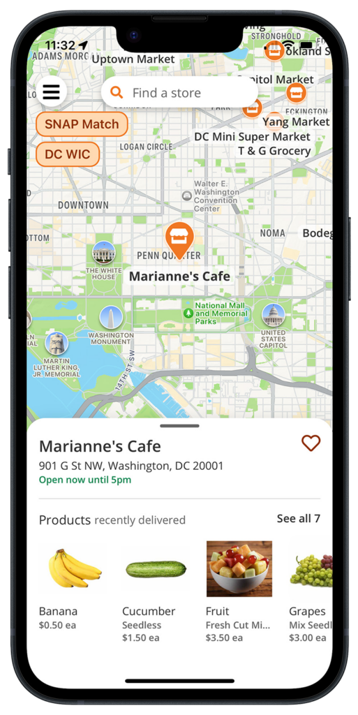
In 2022, DCCK came to Blue Raster with the Healthy Corners Shopper app—originally developed by students at the University of California, Berkley—with the goal to display corner stores in DC neighborhoods that offer fresh, affordable produce to residents through the Healthy Corners program.
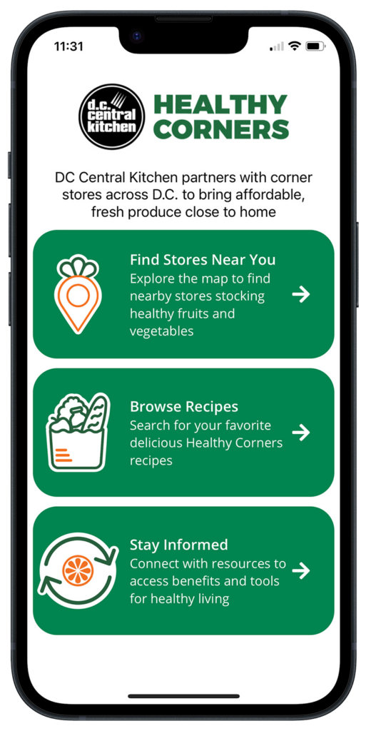
DCCK wanted a user-friendly application that would clearly show customers product availability by location and offer free recipes, resources, and more to inspire better eating. In addition to showing the location of inexpensive produce, the app also notes which stores in the Healthy Corners program offer a “SNAP Match” coupon program for SNAP/EBT customers and/or serve as DC WIC-approved vendors.

An App that Serves Up Real Change

Working off the original application structure, Blue Raster made the Healthy Corners Shopper app production-ready using the cross-platform framework React Native with an innovating backend in Airtable—a low-code platform for building applications.

Since 2020, DCCK’s Healthy Corners program has assisted in selling over 1.2 million units of healthy food options in DC corner stores (Source: https://dccentralkitchen.org/healthy-corners), and the Healthy Corners Shopper app is only helping that number rise. Interested individuals can download the app for free on their Android or iOS device—with exciting, new features coming soon thanks to the continued collaboration of DCCK and Blue Raster.

Strengthening Food Security in DC

Learn more and explore DCCK’s Healthy Corners Shopper app here, or contact Blue Raster today to discuss our hands-on process for creating custom mobile applications.

TrailsMV Mobile Application: Explore Martha’s Vineyard’s Nature Trails

TrailsMV mobile app is the modern day treasure map   

The TrailsMV mobile application is an immersive experience developed by Blue Raster in collaboration with the Sheriff's Meadow Foundation (SMF) and their conservation partners. Designed to cater to hiking enthusiasts, residents, and visitors of Martha's Vineyard, MA, TrailsMV offers an interactive guide to over 220 miles of public trails spread across one hundred protected properties. 

This easy-to-use app allows users to: 

  • browse places to explore through the interactive map 
  • explore Martha's Vineyard trails with confidence through in depth property details 
  • get important alerts about trail closings and guided hikes    
  • learn about the island's rich natural history 
TrailsMV Mobile

TrailsMV provides a comprehensive resource for adventurers through detailed maps, property descriptions, and upcoming event listings. Moreover, users can access curated excursions, informative seasonal articles, and stay informed about upcoming events.

Featured in The New York Times, TrailsMV is an interactive guide to 220+ miles of public trails on more than 100 protected properties across the island of Martha’s Vineyard.

One key feature of the project is the seamless integration of ArcGIS Online data and maps with relevant contextual information, such as photos, text, and directions. Blue Raster developed flexible and repeatable backend workflows to consume dynamic content in the application. Leveraging Survey123 allows the team at Sheriff's Meadow Foundation the power to update, add, or remove content from the app without need for a developer to manually make modifications.

TrailsMV was built using AppStudio for ArcGIS and the ArcGIS Runtime API for Qt (Runtime). With Esri’s recent retirement announcement of ArcGIS AppStudio, Blue Raster will work with Sheriff’s Meadow Foundation on migration options to a new framework.

Incorporating the power of ArcGIS Online, Survey123, and thoughtful design, TrailsMV Mobile Application brings the beauty of Martha's Vineyard's trails to the fingertips of users, empowering them to explore, connect with nature and others, and discover what the island has to offer.

Featured in The New York Times, is an interactive guide to 220+ miles of public trails on more than 100 protected properties across the island of Martha’s Vineyard.

Download TrailsMV Today

Available in the Apple AppStore and the Google Play Store!

Contact Us

  • This field is for validation purposes and should be left unchanged.

Empowering Freshwater Communities and Indigenous People through Immersive StoryMaps

Freshwater ecosystems contain an incredible 10% of the world’s known species and support the livelihoods of billions of people including many Indigenous Peoples and local communities. However, since 1970, freshwater plants and animals have declined by 84% due to threats like poor fisheries management, watershed degradation and overuse. The Nature Conservancy is partnering directly with local communities around the world to apply traditional knowledge and co-create new, science-based conservation strategies.

To tell the story of its partnership with these Indigenous People and Local Communities, The Nature Conservancy employed the services of long-time partner, Blue Raster to develop a series of Storymaps to shed light on TNC Freshwater Community-Led Conservation Program’s work with freshwater communities and indigenous people, highlighting their efforts to propagate and enhance community-led conservation initiatives across Africa and Latin America.

TNC's collaboration with communities in Africa is focused on three critical regions: the Bas Ogooué wetland area in Gabon, the upper catchment of the Okavango Basin in Angola, and the remarkable Lake Tanganyika, which borders Tanzania, Zambia, the Democratic Republic of the Congo, and Burundi. In Latin America, TNC's collaboration with communities extends to the Andean Amazon region in Ecuador, Colombia, and the Tapajos River Basin in Brazil. These ecosystems are not only home to remarkable biodiversity but also provide essential resources and cultural heritage for indigenous peoples. By partnering with local communities, TNC aims to strengthen their capacity to manage and protect their ancestral lands sustainably.

Blue Raster's expertise in utilizing ArcGIS StoryMaps has allowed TNC's conservation efforts to be communicated effectively, enabling users to engage deeply with the stories being shared. By combining rich media, interactive maps, and engaging narratives, the StoryMaps create a powerful medium for storytelling. The StoryMaps developed by Blue Raster incorporate compelling graphics, audio soundscapes, maps developed and published in ArcGIS Online and high-resolution images, capturing the essence of the fisheries, landscapes, communities, and wildlife that TNC works tirelessly to protect. These visuals not only enhance the aesthetic appeal but also serve as a means to evoke emotions and foster a sense of connection with the featured regions. Developed in English, the StoryMaps created are also available in African French, Latin American Spanish, and Brazilian Portuguese translations.

These maps not only offer a geospatial perspective of TNC's work but also provide users with an opportunity to explore the geographical context and understand the intricate relationships between freshwater habitats and communities. Through the interactive maps, readers can visualize the conservation initiatives, the areas of focus, and the significance of indigenous and local community participation. By utilizing ArcGIS StoryMaps as a powerful storytelling tool, TNC can effectively communicate its vision for the future, emphasizing the importance of continued partnerships and collaborative efforts with indigenous people and local communities. The immersive nature of the StoryMaps helps stakeholders envision a future where freshwater ecosystems thrive, and IPLCs actively contribute to their protection.

The collaboration between Blue Raster and The Nature Conservancy is a testament to the power of technology and partnerships in conservation efforts. Through the creation of immersive StoryMaps, TNC's work with freshwater communities and indigenous people in Africa and Latin America is brought to life. By amplifying these stories in local languages, Blue Raster and TNC empower communities to take an active role in preserving their natural heritage and build a future where people and nature thrive in harmony. Together, they are forging a path towards a more sustainable and equitable world.

“The Freshwater Community-Led Conservation Program is excited about our story map, made in partnership with Blue Raster. We hope those who engage will learn about the important efforts of the local communities, partners and TNC staff in freshwater fisheries and biodiversity conservation and feel invited to participate. The story map platform both allowed us to tell the efforts of our program as a cohesive unit across our work in Latin America and Africa and allowed us to highlight the unique impacts specific to local communities and partners.”
-
Allison Aldous, Director of the Freshwater Community-Led Conservation Program

APGA Puts on a Texas-Sized Show in Fort Worth

Last week was the American Public Garden Associations' (APGA) Annual Conference in Forth Worth, Texas. Over 1,000 people in the community attended to learn from each other's success stories and best practices around garden management, public engagement, horticulture, plant curation, conservation, and education.

Christopher Gabris, Blue Raster’s Public Gardens Practice Lead, traveled to network with existing partners and share with other conference attendees how Blue Raster is using Esri’s ArcGIS platform to modernize public garden GIS and mapping workflows.

Conference highlights included a Southern Garden Charm dinner party and drone light show at the Dallas Arboretum, and celebrating the Modern West at the Fort Worth Botanic Garden.

Blue Raster currently works with over a dozen public garden, arboreta, and cemetery clients. Our team designs and develops workflows for creating and updating plant collections from out in the field, syncing botanical data with popular repositories, building interactive web and mobile mapping applications for the public, and training public garden staff on maximizing the use of GIS software.

We look forward to continued engagement with the American Public Garden Association community throughout the year and presenting our work at the 2024 conference in Boston!

See how Blue Raster can help modernize your public garden and cemetery workflows today!

Conducting Research and Data Analysis for The Nature Conservancy’s Coastal Restoration Opportunities Project

The Nature Conservancy (TNC) is a global environmental nonprofit that works to conserve the vital bodies of water and land on our planet, and it is also a long-term partner of Blue Raster. From 2021 until 2023, Blue Raster once again collaborated with TNC to help the organization with a project that aims to restore critical coastal habitats.

Determining Goals for TNC’s Coastal Restoration Opportunities Project

TNC required Blue Raster’s support in meeting its main goals for the Coastal Restoration Opportunities project, which included:

  • Delineating, mapping, and quantifying coastal restoration opportunities for five coastal habitats in the United States
  • Establishing natural historical and current habitat occurrences through research, subject matter expert surveys, and literature reviews
  • Creating interactive restoration opportunities maps

A Mission Rooted in History

Unlike some of the past projects for TNC, this one did not involve an application build-out. Instead, Blue Raster’s Abigail Krump and Jen Kern worked closely with TNC staffer, Bryan DeAngelis, and ocean resiliency expert, Annick Cros, to find, analyze, document, and map valuable datasets for the project. The five main datasets, which are habitats targeted for restoration opportunities, include:

  1. Oyster beds
  2. Salt marshes
  3. Mangroves
  4. Seagrass beds
  5. Kelp

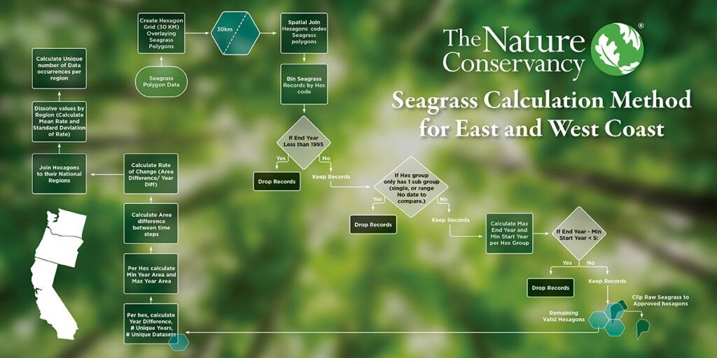
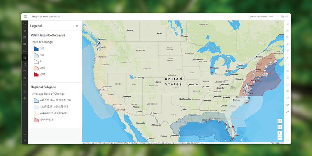
In order to establish a historical baseline for the Coastal Restoration Opportunities project, Krump and Kern had to look at existing datasets from the government, satellite imagery, old scientific papers, and more. Inside the scientific papers, Krump and Kern often found hand-sketched maps or survey notes, which they then transformed into interactive restoration opportunities maps.

Coastal Restoration Opportunities

Impacting the Future of Restoration

The historic data collected by both teams has been published in various scientific journals and is available for scientists and coastal habitat experts to use for their own purposes, but the main goal is for it to be used to support and build cases for funding coastal restoration projects.

And the influence of TNC’s Coastal Restoration Opportunities project hasn’t halted since Blue Raster completed the research, data analysis, and map creation to produce the historical benchmarking resource the nonprofit requested. In fact, the datasets are already being used to support the pending legislation of California Assembly Bill 1407, the Ocean Life Recovery Act. If passed, Assembly Bill 1407 would protect California’s ocean ecosystems, including kelp, eelgrass, and native oysters, by launching essential restoration projects with the necessary backing from the state.

Could your organization’s data help change the world? Find out with research and data analysis support from Blue Raster.


Page 2 of 32