Our Work

Blue Raster helps you tell your story through interactive
mapping technology. Make your message clear, exciting,
and user-friendly for both mobile and web platforms.

Filter

New Updates to The DHS Program Spatial Data Repository: A one stop shop for Spatial Analysis Datasets

You may be familiar with the USAID funded DHS Program Spatial Data Repository (SDR) and use it to access spatial and non-spatial indicator data produced by The DHS Program surveys.  However, if you have not visited recently or are new to the tool check it out today!

The DHS Program Spatial Data Repository


There are brand new features, like a Model Dataset to use for familiarizing yourself with The DHS Program data, lesser known features like Geospatial Covariates and Modeled Surfaces and even some amazing new visualizations under construction that will debut in spring 2024.

Model Dataset

The new Model Dataset is useful for learning how to use DHS Program data to produce your own results.

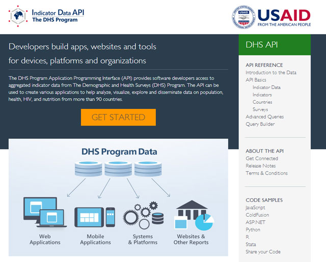
The SDR is a custom application built with JavaScript, HTML, CSS, Python, Node and other tools. It relies on Esri’s ArcGIS Enterprise for serving boundary files, Python tools for creating customized datasets and The DHS Program Indicator Data API for instant access to the vast universe of DHS Program survey data and Amazon Web Services (AWS) for hosting and serverless solutions. Blue Raster is a trusted technology partner to The DHS Program with over 15 years of dedicated service to the USAID funded project.

Keep your eye on this space and visit the Spatial Data Repository today!

Survey estimates

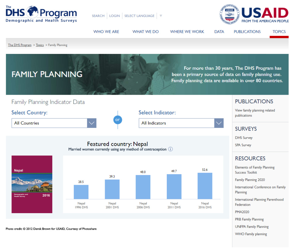
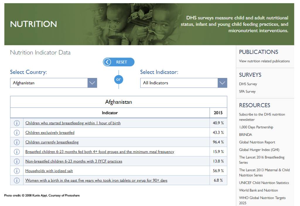
Download Modeled Surfaces produced from DHS Program survey estimates like this one from the Philippines.


Look Good, Feel Good: DHS Program Launches Re-Designed Website

DHS website header

Having access to global population and health data is critical to understanding and addressing public health issues. The Demographic and Health Surveys (DHS) Program collects and disseminates nationally representative and accurate data on population, health, and nutrition data across more than 90 countries.

This year, Blue Raster worked with The DHS Program to re-design and launch its website. The modernized look and simplified layout make it easier than ever for users to access what they need: country-specific data, powerful tools and resources, survey reports, and more.

The DHS Program's website is also mobile-friendly, meaning you can access it anytime and anywhere on your mobile device.

A new, clean look offers a feel-good navigation.

DHS_01_Mobile

1. Explore by Country search

Search for your country of interest immediately after opening the website. Navigate to country-specific reports and statistics through this panel.

2. Featured Tool panel

DHS provides powerful tools to explore and download data. This panel gives you the chance to explore tools you may not have known about before.

DHS website

3. Tools & Resources panel

View and access the complete collection of tools and resources that help make the most use of country data. This handy panel displays all of the available items. Additionally, it allows you to sort by type in order to view featured items or sort by analysis and learning tools.

DHS website Tools

4. Publications panel

View the most recent publications or search based on a country, topic, or survey. The DHS Program is known worldwide for its rigorous collection, analysis, and publishing of their data through these reports.

DHS website blog post (1)

5. DHS Topics panel

Another way to access data and reports is through the DHS topics menu. Select topics like Malaria, Maternal Mortality, Gender, and much more.

DHS website blog post (4)
DHS_headshot


Sunita Kishor, Director of The DHS Program had this to say “ ….congratulations to our amazing website team for the public launch of the ‘new’ DHS website….Thank you for making us all so proud.”

Learn more about our work with The DHS Program and STATcompiler.

In addition to leveraging Esri technologies for web mapping solutions, Blue Raster leverages our in-house design team to enhance user experiences through design-driven solutions. Read about the design work we have done for ocean conservation.

Dig deeper with new Topics pages from The DHS Program

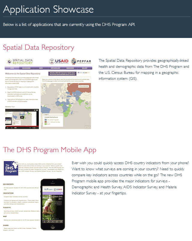
Blue Raster is a long term partner of USAID funded The DHS Program – since 2009 we have collaborated on and created such tools as STATcompiler, Spatial Data Repository, The DHS Program Mobile app, The DHS Program API and the central communications hub: DHSProgram.com.

The DHS Program API already powers the STATcompiler, Mobile App and SDR- and now you can visualize the indicator data that the API provides on DHSProgram.com as well.

New Topics pages have been created to help interested users narrow their focus and uncover relevant indicators:

The topics pages showcase the latest relevant survey data and were built using HTML5 and JavaScript.  Each page is essentially a mini application that calls to The DHS Program API to automatically update when new surveys are released so that the freshest data is served and visualized.

,

Some Topics pages, such as Gender, allow users to easily compare certain indicators side by side in a table- new functionality specific to the Topics pages.  Handy links to contextual information are provided in the page sidebars.

More topics pages are on the way…see this post by The DHS Program and you can help decide what comes next!

“Data visualization has always been a key part of communicating DHS data to our audiences. We started with STATcompiler, a tool allowing users to create custom tables based on thousands of health indicators across over 90 countries and compare trends across time. Now, with the continuing support from Blue Raster, we’re pleased to see we have expanded our data visualization practices to our topic pages. With their guidance, we’ve developed a simplified version of STATcompiler as a mini-tool easing our users into the world of data visualization of DHS data.”

Sarah Kim, Digital Media Specialist, The DHS Program


DHS Program Mobile App v2.0 Released

Blue Raster is excited to announce the release of the The DHS Program Mobile App v2.0. A more intuitive interface, offline data download feature and enhanced cartography are a few of the upgrades creating excitement around v2.0.

Here’s a first look at what’s new in this release.

DHS-Mobile-2015-as-released_Compilation

125 indicators

Now when you use the app, you have access to 101 additional indicators — providing more than three times as much data than was previously accessible in v1.0. Behind the scenes, data is being supplied by the STATcompiler database through The DHS Program API. This ensures that you always have up-to-date data, even as new countries and indicators are added or adjusted.

Beautiful, clear design

We updated the look and feel of the app to give you a more compelling, intuitive user experience. We also revamped the maps to feature the latest in cartographic design allowing for better interpretation and clarity.

Take data offline

In v1.0, you could display trends for a single country through Quickstats and compare and contrast 25 preloaded indicators through a series of tables, charts and maps. Now v2.0 features the ability to download Quickstat data packages by country, making complete sets of data accessible even when offline. Through a combination of SQLite, Adobe PhoneGap, HTML5, AngularJS, and JavaScript, Blue Raster and The DHS Program are able to provide far more indicators offline to Android and iOS users.


Get the app for your device today.

DHS Program Indicator Data API Opens Door for Innovative Apps

On the heels of the White House’s commitment to open data, Blue Raster collaborated with ICF International under The Demographic and Health Surveys (DHS) Program to build the DHS Indicator Data Application Programming Interface (API). Funded by the United States Agency for International Development (USAID), the API provides users direct access to over 30 years of Demographic and Health Survey (DHS) data for more than 90 countries covering almost 1,500 indicators – more than 3 million records. By using this tool, developers, analysts, and researchers can obtain DHS data programmatically and develop applications that suit their needs.

DHS Program API Homepage

The API was developed by Blue Raster on the ColdFusion Web Application platform. Developers can query the DHS data using both a RESTful interface, which allows selecting parameters including countries, indicators, and surveys, as well as a conventional query-based interface which provides advanced options for obtaining more customized results. For those looking to query large sets of data, the API offers additional parameters that control the format, citation, and version information. Additionally, JSON, XML, CSV and HTML output formats are supported to provide users with flexibility.

DHS Program API Application Showcase

In the spirit of openness, the DHS Program has put together tips and code samples in JavaScript, ColdFusion, .NET, Python, R, Stata, and more to help users get started. You can even register to be a DHS API partner which allows you access to a larger number of entries returned per page and assistance in application development.

Trever Croft, DHS Program’s Capacity Strengthening Technical Coordinator, says:

“The DHS API provides a new level of access to DHS data. Blue Raster has produced a wonderfully simple but powerful tool that will power both the DHS website and STATcompiler as well as users and developers own applications.”

For more details, visit the DHS Indicator Data API website. Let us know if you build an app, and follow the API on Twitter (@DHSprogramAPI).


Page 1 of 5