Esri

AppStudio Retirement: Esri Announces Major Update

Esri has announced version 5.5 of their low and no-code mobile development framework, AppStudio, will be a Long-Term Support (LTS) release for the product. Version 5.5 of AppStudio will be its last major release with the product being retired in February of 2025. Blue Raster has developed and maintained AppStudio applications for clients such as the U.S. National Arboretum, Sheriff’s Meadow Foundation, the Ohio Department of Natural Resources, and more.

Migrate Your Legacy Platforms

As the digital landscape shifts, the phasing out of AppStudio necessitates a seamless transition for your applications. Our seasoned team can expertly migrate your legacy systems to robust native iOS and Android platforms, utilizing cutting-edge languages like Swift and Kotlin. Ensure your mapping applications remain at the forefront of technological advancements, delivering unparalleled performance and user experience.
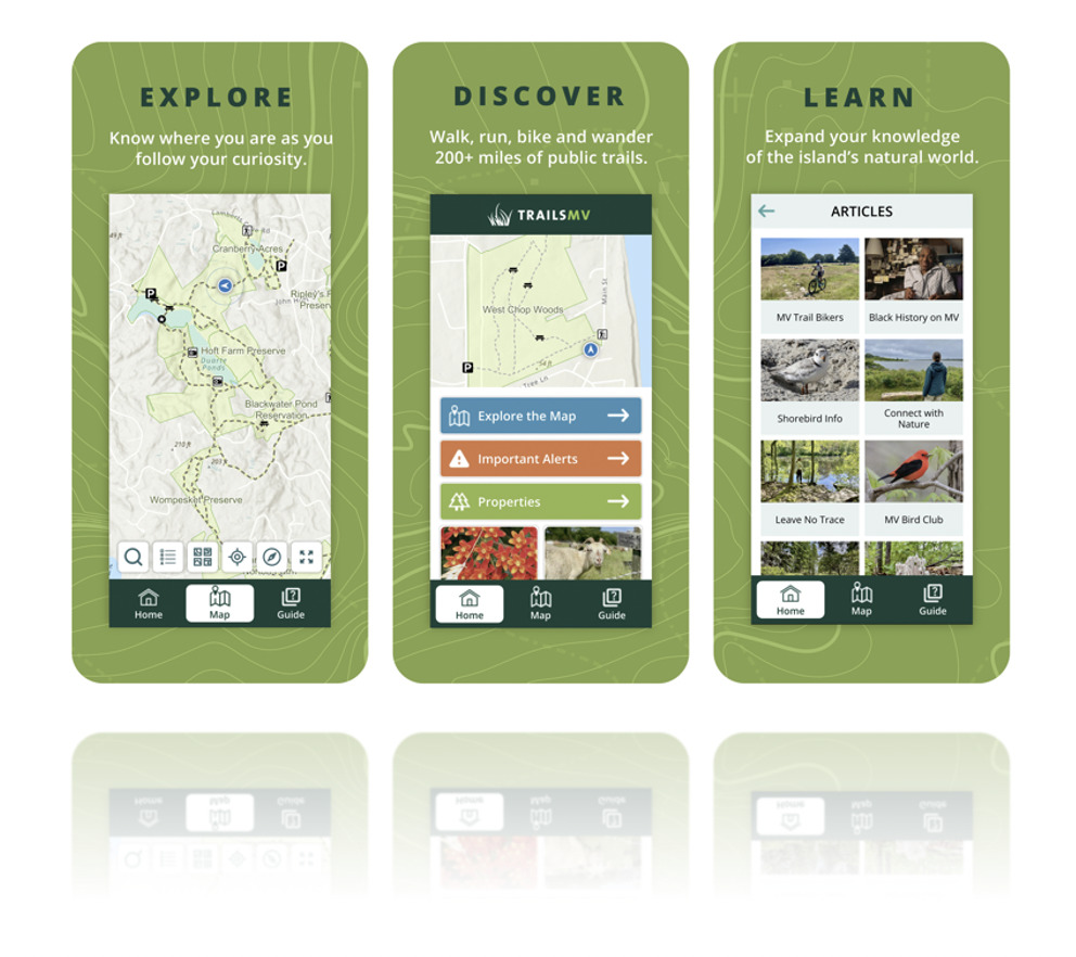
AppStudio 1

Transitioning from AppStudio

While AppStudio will be fully supported for the next two years, it is important to become familiar with the ArcGIS mobile application roadmap for the development of new applications or the migration of existing applications to a new framework.

Our team of designers and developers at Blue Raster are well versed in the suggested roadmap outlined by Esri for mobile application development—and we’re ready to support your vision. If needed, we can also assist your organization with migrating existing applications using the recommended frameworks or transitioning to the most efficient technologies for your current or future mobile applications. Our expertise includes:
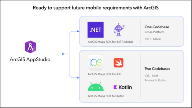
Mobile application pathways for development or migration

Top-Tier Support for Your Mobile Application Needs

Our team is ready to help you with your mobile application development and migration needs--contact us today to learn more!

For more information about Version 5.5 of AppStudio and the product’s long-term future, visit the Esri ArcGIS Blog announcement.

Esri Streams Real-Time Data to ArcGIS Online with Velocity

It’s no secret that data empowers educated decision-making; however, with our rapidly evolving data landscape, this cannot be a stagnant process. As the need for real-time data continues to rise, the options that allow us to access the most current information only get better.

To offer this level of real-time data monitoring to ArcGIS Online users, Esri developed ArcGIS Velocity to integrate with IoT sensors, allowing users improved access to up-to-the-minute data. ArcGIS Velocity is Esri’s cloud-based Saas Solution for near real-time data streaming and Big Data Analytics. Similar to how Geoevent for ArcGIS Enterprise allows the ingestion and visualization of data streams, Velocity takes advantage of Kubernetes in the cloud to offer streaming and analytics of massive-scale datasets—that would otherwise be too large for analysis without dedicated computing infrastructure.

ArcGIS Velocity Brings Data Streaming and Big Data Analytics to Our Fingertips

ArcGIS Velocity allows users to configure data feeds from cloud service providers such as Azure and AWS, web messaging formats like HTTP and RSS, or directly from Automatic Vehicle Locator (AVL) providers, such as Geotab. Once a data feed has been established, the stream can be integrated directly into ArcGIS Online anywhere there is support for Stream Services.

Users can also use the established feed as a source in Velocity Analytics to enhance the feed with outside data sources or make on-the-fly calculations before being published as a Hosted Feature Service in ArcGIS Online. Enhancements include:

  • Adding indicators from Esri’s Living Atlas using spatial joins
  • Summarizing values from multiple sources to create a composite score or average sensor reading over time
  • Calculating motions statistics like compass bearing and movement speeds for AVL

Velocity also allows for multiple feature layers to be published from the same source, making it possible to keep a historic archive of all data collected from a feed for long-term analysis while also separately publishing the most up-to-date data.

Velocity’s Big Data Analytics gives users the ability to analyze massive amounts of data without the need for their own on-premises or cloud infrastructure. Taking advantage of Kubernetes to allow for scalable processing, users have access to Velocity’s cloud infrastructure to run large-scale analysis on data from sources such as:

  • Data in their own existing feeds and historic feature services
  • Hosted services published to the web
  • Datasets hosted in cloud storage—like Azure Blob Storage and Amazon S3

Big Data Analytics in Velocity gives users the ability to process massive datasets, including multiple CSVs from S3 hosting millions of individual data records, and create a predictive model of things like forest loss, crime hotspots, or future crop yields based on previously collected data.

AVL

Deploying ArcGIS Velocity for Blue Raster’s Local Government Clients

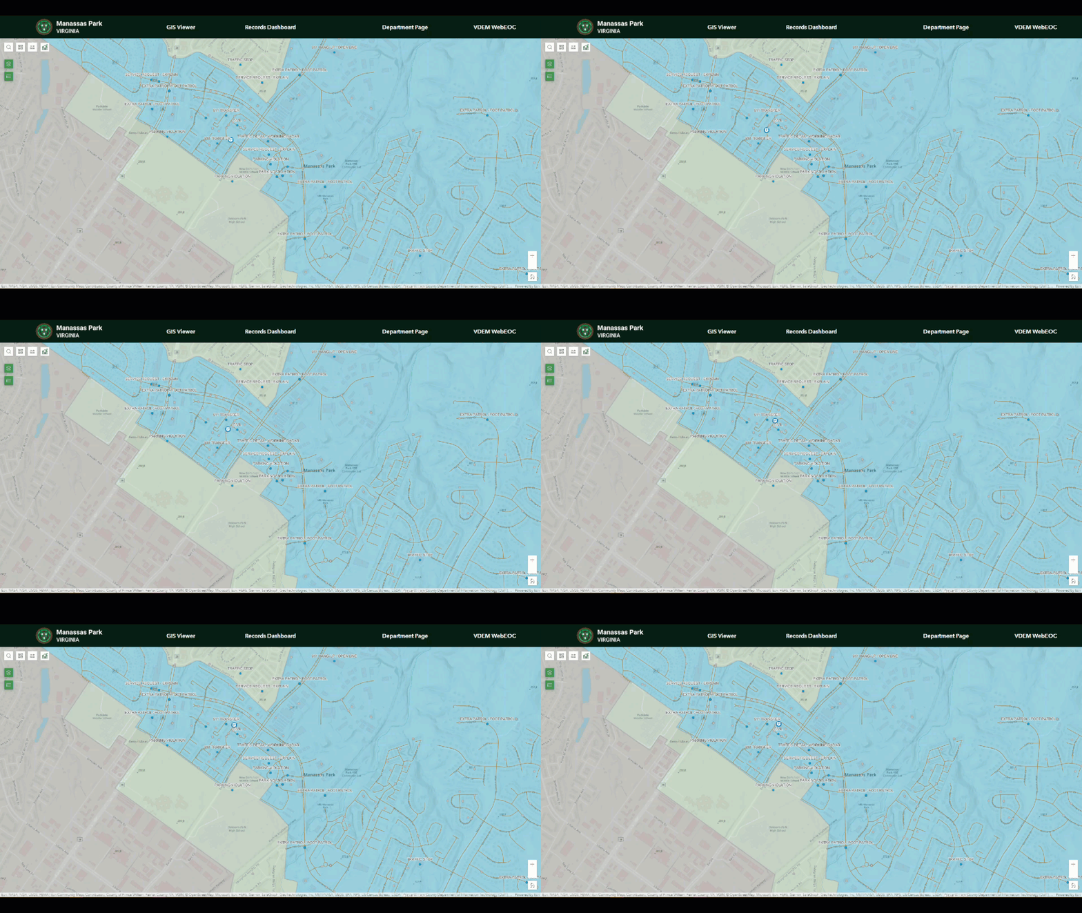
Blue Raster understands the value ArcGIS Velocity can bring to customers. Since 2020, we have been working with the City of Manassas Park in Northern Virginia to implement ArcGIS workflows and solutions citywide—supporting law enforcement, fire safety, zoning, public works, and more.

Manassas Park needed the ability to visualize AVL in some of their public safety vehicles. We were able to configure two feeds as an early concept for the city—making them an early user and success story for ArcGIS Velocity.

  1. The first feed was processed from AVL units through Azure Event Hub to ArcGIS Velocity.
  2. The second feed was for the city Computer Aided Dispatch that is served by an HTTP service using Azure Function Apps to prepare the data for ArcGIS Velocity.

The work for Manassas Park was even the focus of an Esri case study—published in the fall of 2022—highlighting the adoption of ArcGIS Velocity by a city government. This story has also been presented by Esri and Blue Raster at FedGIS 2023.

As the need for real-time data monitoring expands, Blue Raster is excited to share the success of ArcGIS Velocity for Manassas Park as we explore ways to increase the use of Velocity for more of the Manassas Park fleet. ArcGIS Velocity offers a unique product for real-time data visualization and incorporation into many applications on the ArcGIS Platform, as well as seamless integration into existing Cloud GIS Infrastructure with the added benefit of access to Big Data Analytics.

Real-Time Data Experts

As an Esri Gold Business Partner in the State and Local Specialty, Blue Raster is the service provider you can trust with your real-time data needs.

Esri ArcGIS Cloud Specialty: Elevating our clients’ GIS capabilities to the sky

Blue Raster is thrilled to be a member of the Esri ArcGIS Cloud Services Specialty. This specialty designates Blue Raster as an expert in deploying and managing ArcGIS in cloud environments such as Amazon Web Services (AWS) and Microsoft Azure. The Cloud Specialty program is designed to help Esri connect customers with recognized Partners that can best provide ArcGIS cloud solutions. Partners that meet the criteria for this specialty must demonstrate a track record of delivering value to their customers in implementing, managing, and designing cloud infrastructure in the Esri ArcGIS environment.  

Esri Cloud Services Specialty

To attain this specialty, Esri assessed Blue Raster’s expertise in the following areas of ArcGIS Cloud services: cloud deployments, system architecture and design, migrations, and managed services. Our deployments of ArcGIS Enterprise in the cloud include routine monitoring and maintenance to allow us to fine tune the system as needed, ensuring reliability and performance. Our system architecture and design experience encompasses single machine and multi machine architectures in both AWS and Azure that are customized to our clients’ specifications. We support all types of migrations including on-premises to cloud provider migrations, ArcGIS Online to ArcGIS Enterprise, and integration with third party providers.

Our portfolio of managed services includes the utilization of a wealth of Esri products and tools in the ArcGIS family such as ArcGIS Enterprise, Data Store, GIS Server, GeoAnalytics Server, GeoEvent Server, Notebooks, Image Server, Pro, Monitor, and Enterprise Geodatabases. Implementing these tools empowers us to provide a number of managed cloud services to our clients including design consultation, server construction, Esri software installation, infrastructure troubleshooting, distributed systems configuration, geographic redundancy configuration, OS patching, Esri security patching, routine Esri patch deployment, DevOps services, and user training services, among others. Blue Raster is primed and ready to meet our clients’ needs in all areas of the Esri ArcGIS cloud.

ArcGIS Cloud Solutions by Blue Raster

With over 10 years of experience providing ArcGIS Cloud consulting services, Blue Raster is proud to be a trusted resource for a variety of cloud solutions, including: 

    • Cloud ArcGIS Enterprise implementation 
    • Data migration 
    • System architecture and design 
    • Enterprise migration 
    • Security 

We use our cloud expertise to assist a variety of clients with a range of projects. Our dedicated DevOps team supports our cloud projects from requirements gathering through completion. Keep checking our blog posts for our latest projects as we continually grow and evolve our cloud-based service offerings.  

Are you looking to expand your ArcGIS capabilities in the cloud?
Contact us today to learn more about how we can help!

2022 Esri UC Top Takeaways

Our Esri UC Recap

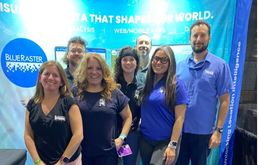
Last week Blue Raster attended the largest GIS event of the year: the annual Esri User Conference in San Diego, CA. The event gathered almost 15,000 in-person attendees from around the world and over 16,000 digital attendees! Our team came back buzzing about new releases, captivating presentations, and all things ArcGIS. We’re excited to share our experience and what we learned at the 2022 Esri UC! 

2022 Esri UC Blue Raster photo
Jack and Abigail at UC

With ideas flying and new technologies being unveiled, here is what’s new and what our team is excited for: 

  • New field applications are coming out! Our GIS Analyst Abigail Krump is interested in how Quick Capture is building out in complexity and expanding what users can do to provide accurate data. Additionally, new Survey123 capabilities are exciting as a user can now annotate images that are taken, speeding up workflows and adding a level of detail in data capture.  
  • At the UC Plenary Session, the entire crowd erupted with excitement about ArcPro Catalog updates that enable you to see when an item was last modified.  
  • New ArcGIS Dashboard updates including being able to download your source data got us excited and our clients are ready to implement the new changes! 
  • Seeing the ArcGIS Online Imagery demo gave us many ideas for how some of our customers can create their own imagery analysis.  
  • New Microsoft Power Automate updates about ready to use flows and the 25 new ESRI templates got the wheels spinning for our team.  
  • Our GIS Analyst Andrew Patterson is excited for the new Field Map updates that enable complex computation utilizing Arcade within the app. 
  • New data is being published to the Living Atlas to symbolize by feature rather than by the entire layer, enabling a user to produce effective and visually appealing maps. 

We'd love to talk with you and share what we learned at this year's User Conference. Contact us today to set up a call! 

GIS - Mapping Common Ground

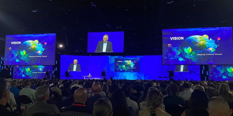
This year’s event kicked off with a Plenary session hosted by Jack Dangermond, Founder and CEO of Esri. We heard from a range of inspiring leaders, including Deanne Criswell from FEMA and Ronan Donovan from National Geographic. The reoccurring theme of the plenary was GIS—Mapping Common Ground, using it as a tool for helping solve challenges in important arenas like climate research, conservation, disaster management, and more. 

2022 Esri UC Plenary

It was exciting seeing David Hayes's talk at the 2022 Esri UC about The National Climate Taskforce focus on climate and clean energy, with an emphasis on equity for disadvantaged communities. A prototype online portal built by Esri aims to provide a central hub of climate-related information for anyone to access. State and local governments can find policy maps, climate data, and links to funding sources to fight climate change.

More Plenary Highlights

The plenary showcased incredible work using ArcGIS Knowledge which enables users to visualize relational data in and outside of space using graph science. Andrew believes there are a lot of opportunities to use this incredible technology with many of our projects.

Disaster response was another important highlight of the plenary, with Esri outlining all of the disaster response solutions and identifying their separate use cases. Our team got to sit down with the disaster response team to hear a summary of what is new and what’s on the horizon with the disaster response program. We learned there is a new national and global level disaster response hub with curated data sets for disaster response deployment.

UC JGI talk
JGI team and Blue Raster

Our work with the Jane Goodall Institute was showcased on the main screen! Blue Raster GIS Analyst Abigail Krump felt that her experience at the UC and plenary brought a lot of context to the purpose of the project as a whole. Abigail came home from San Diego with some serious ideas for how to continue improving the project.

“Seeing it in the context of the community and on the ground work was really refreshing. Alice Macharia, head of African programs of JGI, thanked me for my work which was an incredible honor.”

Abigail was honored and excited to have the opportunity to meet the Jane Goodall Team that she works with remotely. For her, it has been a lifelong dream to work with JGI.  Abigail was impressed by how JGI presented a strong understanding of where conservation science in GIS is moving towards to better serve the communities they are working with. 

2022 Esri UC Highlights

Sustainable World Spotlight

The Sustainable World Showcase is a hub for GIS users working to make strides to support the planet, people, prosperity, and peace. GIS applications under the Sustainable World umbrella included climate change, conservation, disaster response, education, global development, humanitarian, nonprofit, racial equity, and social justice. Blue Raster also sponsored the Sustainable World Community Social on Tuesday night.

2022 Esri UC

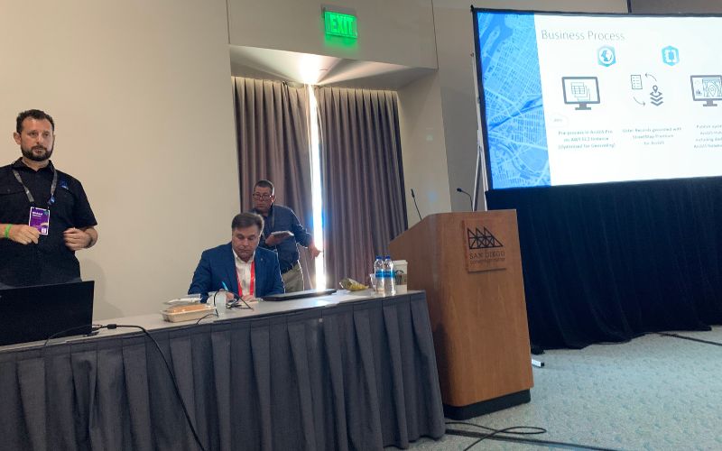
On Tuesday, Eric Ashcroft, Senior Project Manager, presented a lightning talk at the Sustainable World Spotlight Theater: Nonprofit Takeover to discuss Blue Raster Celebrating 20 Years of Supporting Non-Profits​. Blue Raster gave a spotlight to three of our projects: Jane Goodall Institute Tacare Program, World Resource Institute L.E.A.R.N. Tool, and Stimson Mekong Dam Monitor.

ArcGIS Velocity Session 

Our Manassas Park project was featured during the ArcGIS Velocity session. Suzanne Foss, Product Manager at Esri spoke with us one on one about our project which she featured in her presentation on Thursday. She highlighted how Blue Raster is using ArcGIS Velocity in our work. Andrew says it was rewarding to get the reassurance that our team’s work was functional and serving a good purpose, as well as that we are on the right path to develop it further as Velocity develops. This session also demonstrated the capabilities of ArcGIS Velocity and Real Time that we are eager to explore and implement in our work, whether it is for real time data or something like social media data scraping. 

UC Elections SIG

Elections Special Interest Group 


Michael Lippmann presented our work with the Georgia Secretary of State, Election Division on the development of the Redistricting Quality Assurance Tool that enabled Georgia to validate and confirm voting district assignments in 159 counties. In addition, we learned more about what tools are available to deploy through ArcGIS Elections Solutions for the upcoming elections.

Map Gallery

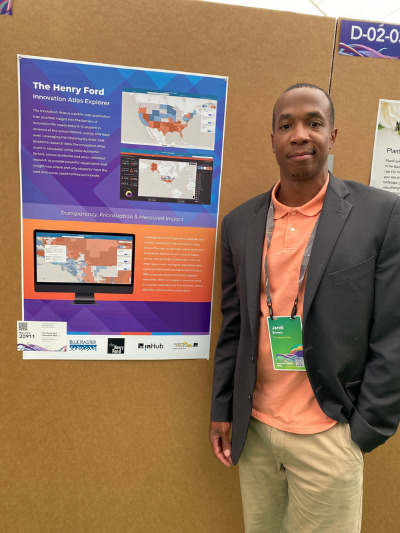
Blue Raster also had the opportunity to showcase four posters designed by our team members in the Map Gallery. We highlighted our work with The Henry Ford, Virginia Department of Transportation, New York Botanical Gardens, and The Stimson Center. We were thrilled to have to opportunity to meet with Jarell Brown from the Henry Ford and Regan Kwan from the Stimson Center at the gallery.

Mary Bracho, GIS analyst, says it was awesome to be recognized by our clients at the Map Expo, and it was interesting to visit client’s presentations. It was Mary’s first Esri UC experience.

“It was very exciting and amazing to be in a room of 15,000 GIS users, it’s not every day that you encounter this environment.” 

Mary also visited several demo theater sessions. As Blue Raster is getting into working more with Esri's ArcGIS Parcel Fabric, Mary had a meeting with the Esri Team and attended demo sessions. These sessions with the product team gave Mary lot of ideas and tools to implement in our own workflows. Mary also got the chance to meet with the ArcGIS Hub team and got to share some of the functionality GIS analysts would love to see from Hub.  

It was incredible to see all our partners, peers, and clients, and it was rewarding for us to see how Blue Raster was welcomed and recognized by our peers and clients as well.  

Thank you to all those that stopped by our booth, presentations, or our Fish Taco night. We hope to hear from you soon!

Contact Us

Let's get your GIS projects started!

Disposal of Debris after Disaster: Blue Raster partners with CDR Maguire to quantify and monitor disposal of debris material

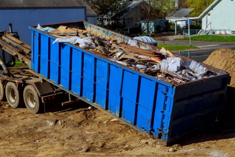
Following a catastrophic event, the assessment and removal of debris and clean-up efforts of those impacted can create a ripple effect of challenges that communities are forced to overcome. To aid in an efficient approach, crews need assistance quantifying the damages incurred and coordination of how best to begin to confront the disposal of debris. After a referral from ROK Tech, CDR Maguire GIS Manager Deepali Datre reached out to Blue Raster to begin work on deploying the Esri Debris Management Solution with a custom enhancement to support online and offline use.

Debris Management

In this data collection phase of disaster response, Blue Raster and CDR Maguire:

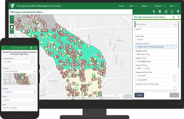
  • Customized and extended the Esri Emergency Debris Management Solution to work offline
  • Configured complex and innovative Survey123 forms
  • Authored and deployed custom Python and JavaScript scripts
  • Recorded information including vehicles in operation, field monitors, type of debris accumulated, method of disposal, and total weight removed per truck load
  • Calculated total weight removed using the truck’s empty and full weight measurements obtained from the weight scales at the final dump location
  • Isolated categorical information including truck certifications, loading tickets by address or parcel, and the amount and type of material removed from each designated site

To manage and visualize the data for CDR Maguire, Blue Raster configured an ArcGIS Experience Builder Reviewer Tool. Utilizing this tool, field contractors can submit field survey forms to develop initial damage reports. The Experience Builder Dashboard provides real-time data to increase oversight and efficiency. These methods provide CDR Maguire with accurate data collection for FEMA reimbursement requirements. Throughout this project, the CDR Maguire team was knowledgeable and a collaborative partner to ensure that a workable solution was created.

Example of ArcGIS Emergency Debris Management Solution, courtesy Esri

While this solution was initially developed to assist in the removal of debris from the Boulder County Marshall Fire, this technology has already been employed to address a similar situation following a wildfire in Texas. The applications of this solution translate to a multitude of circumstances in which the efficiency of response can allow for a swift reaction to any type of natural or man-made catalyst.


Page 4 of 17